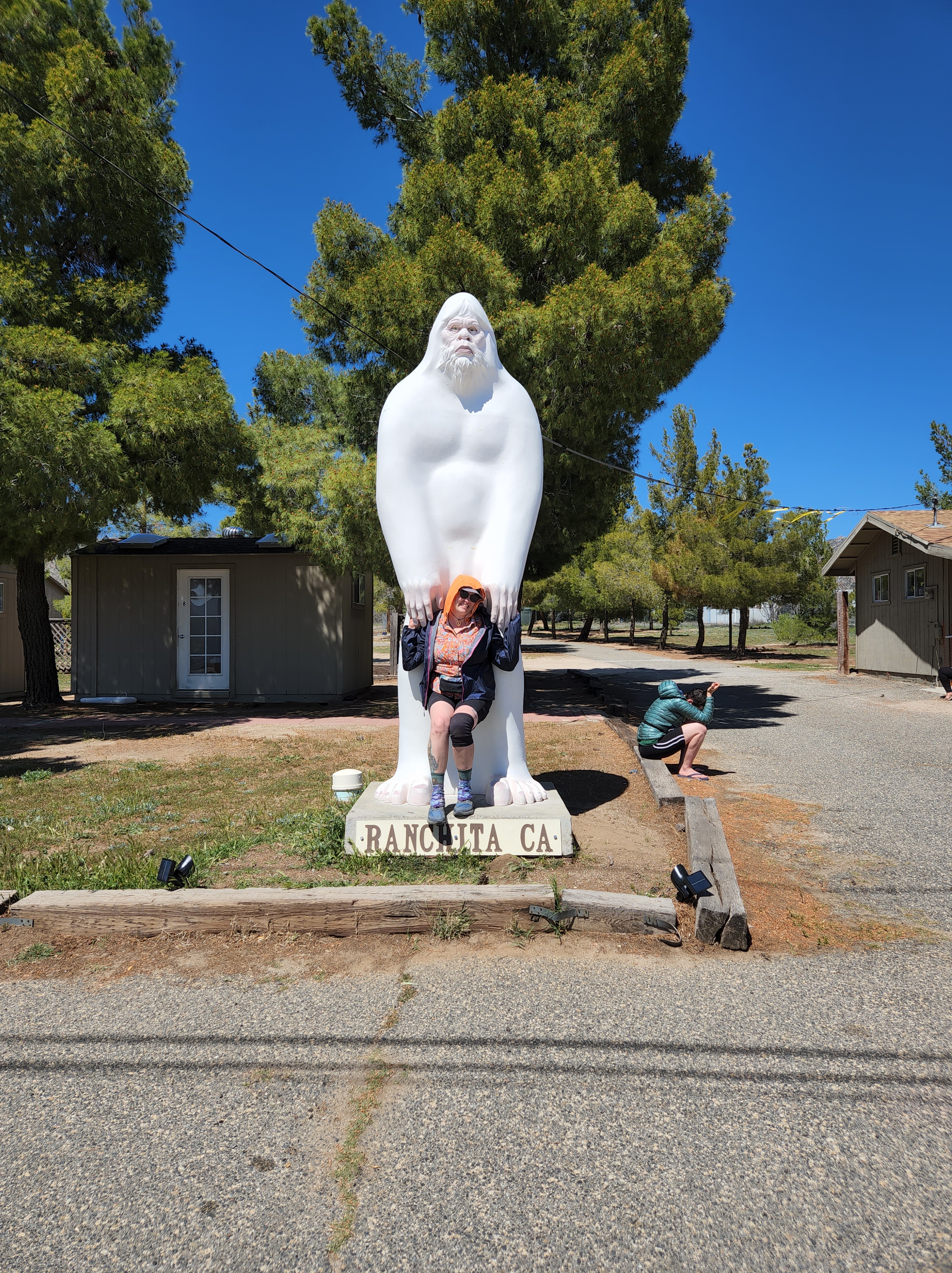
The PCT – The Sierra – Days 59 – 68

Day 59: 19.5 miles

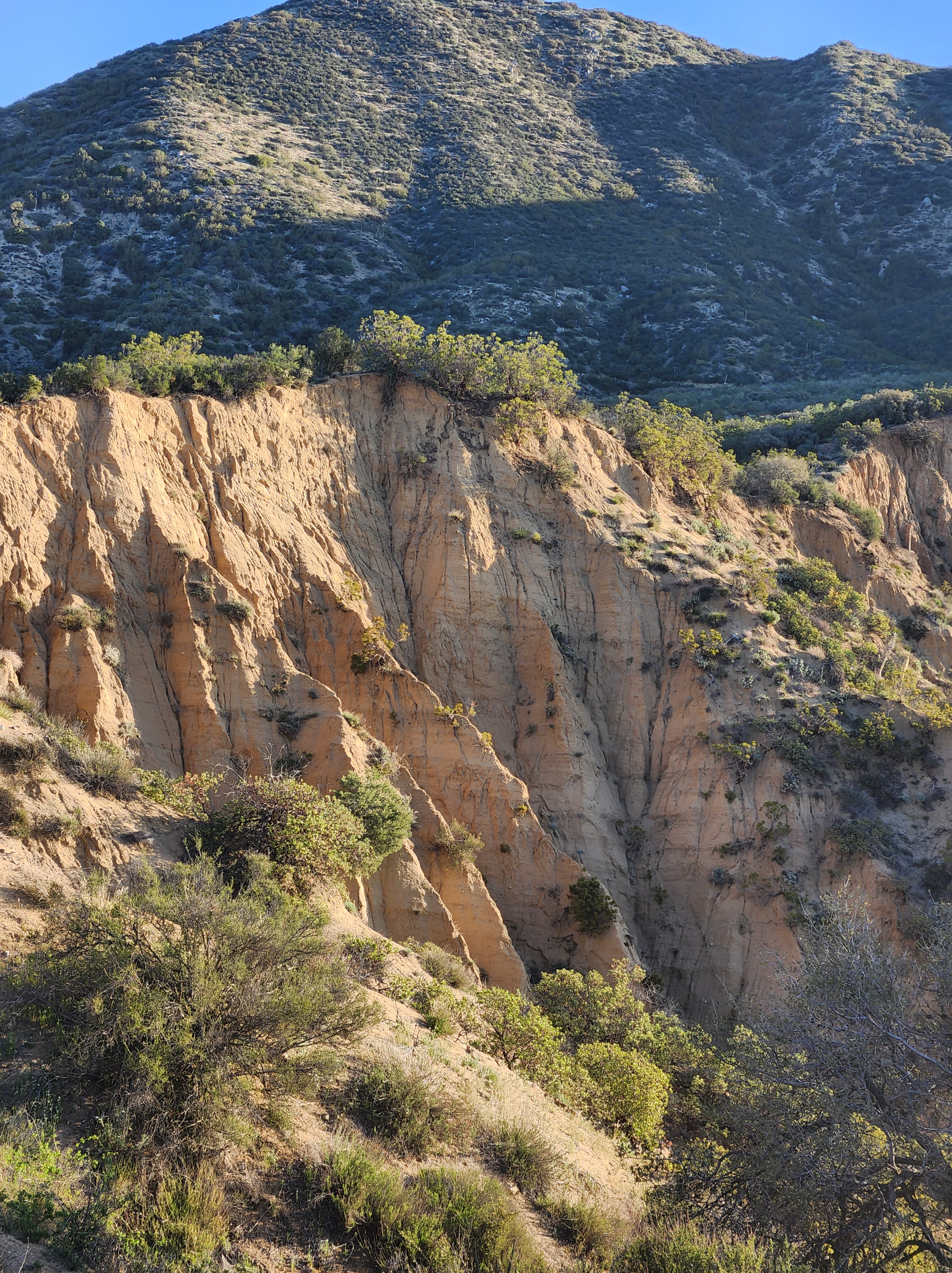
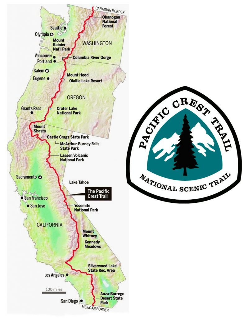
The Sierra Nevada are a roughly 300 mile stretch of the PCT that runs from Kennedy Meadows to Sonora Pass. The elevation is some of the highest in the country and the alpine environment is some of the most remote. The towns are further away which makes help also harder to reach. This section is also touted as one the most beautiful and pristine tracts of trail through national forests and parks. The threat of bear activity is also higher and it is required to carry a bear cannister, a 2 pound addition on its own.

It has caused me quite some anxiety thinking about how hard this next stretch is going to be and all the things that can go wrong. I keep questioning if I am physically and mentally capable of enduring the rigors of the Sierra. Everyone has an opinion on how you should go about it and many of them of are fear mongers. On the one hand I want to be realistic but on the other I don’t want to talk myself out of doing something just because it might be too hard. Listening to others has had me flip flopping on a myriad of opinions. So I decided, I’d just have to see for myself. To go out there and do what I can. If I can’t, I’d turn around and return the way I came.

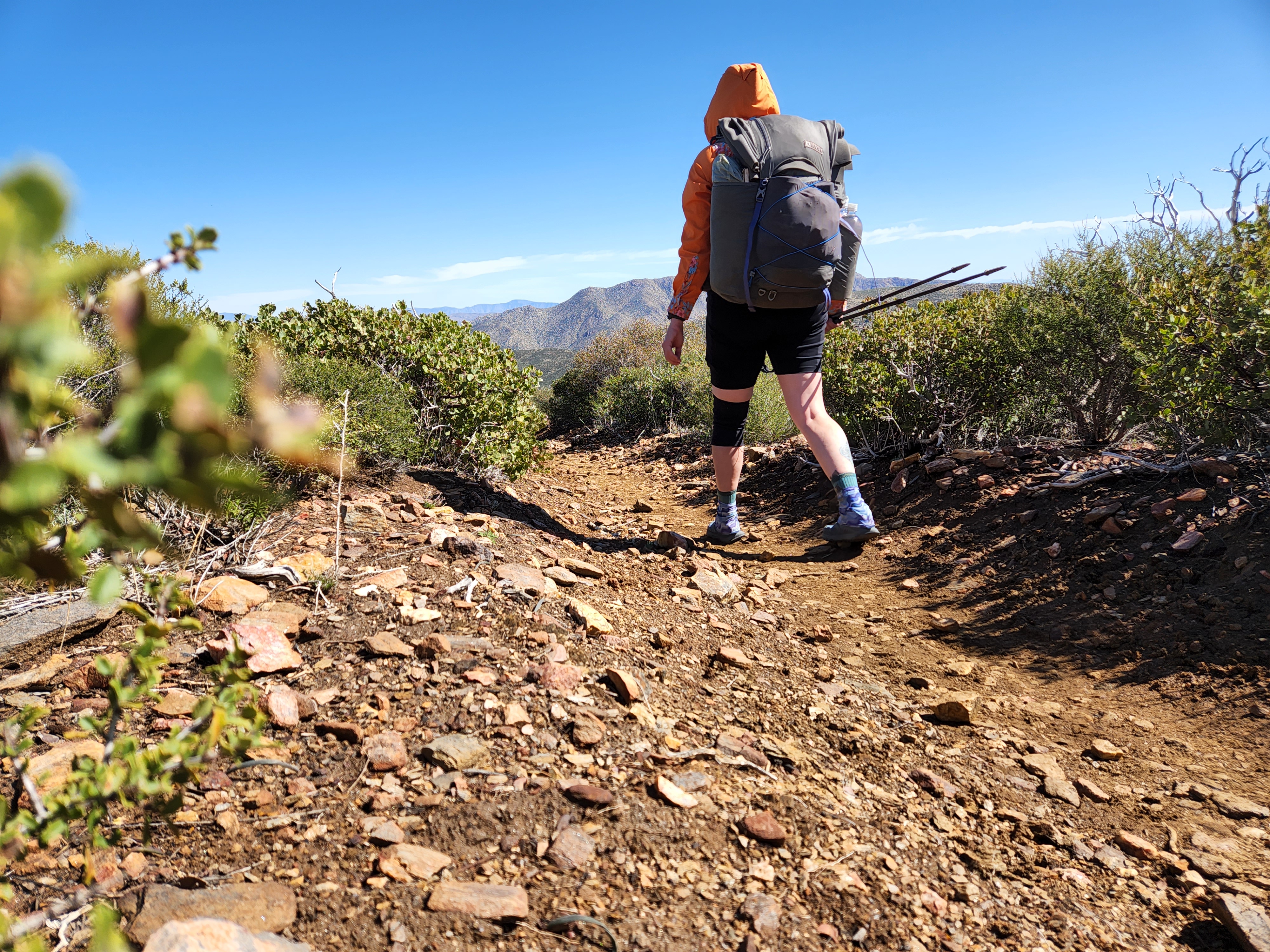
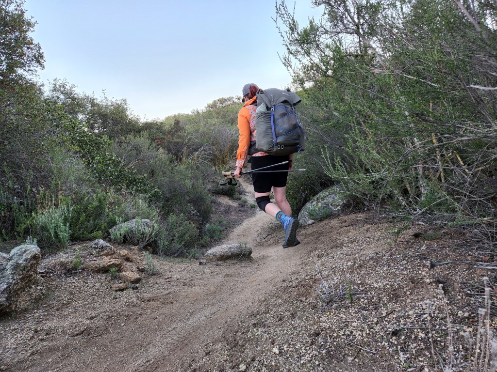
It was with all this in mind as I packed up my gear in the morning to head out into what fear mongers label “the hard crap”. I’ve never used a bear cannister and I eyed its sturdy presence with resignation. It was going to make my pack so heavy and going uphill that much more difficult. I strapped it to the top of my pack and as I was tightening the flap straps, the load lifter on my shoulder strap popped out. Great. Just great. The load lifter strap helps displace the weight of your pack off your shoulders…and it just broke…before the start of one of my heaviest carries.

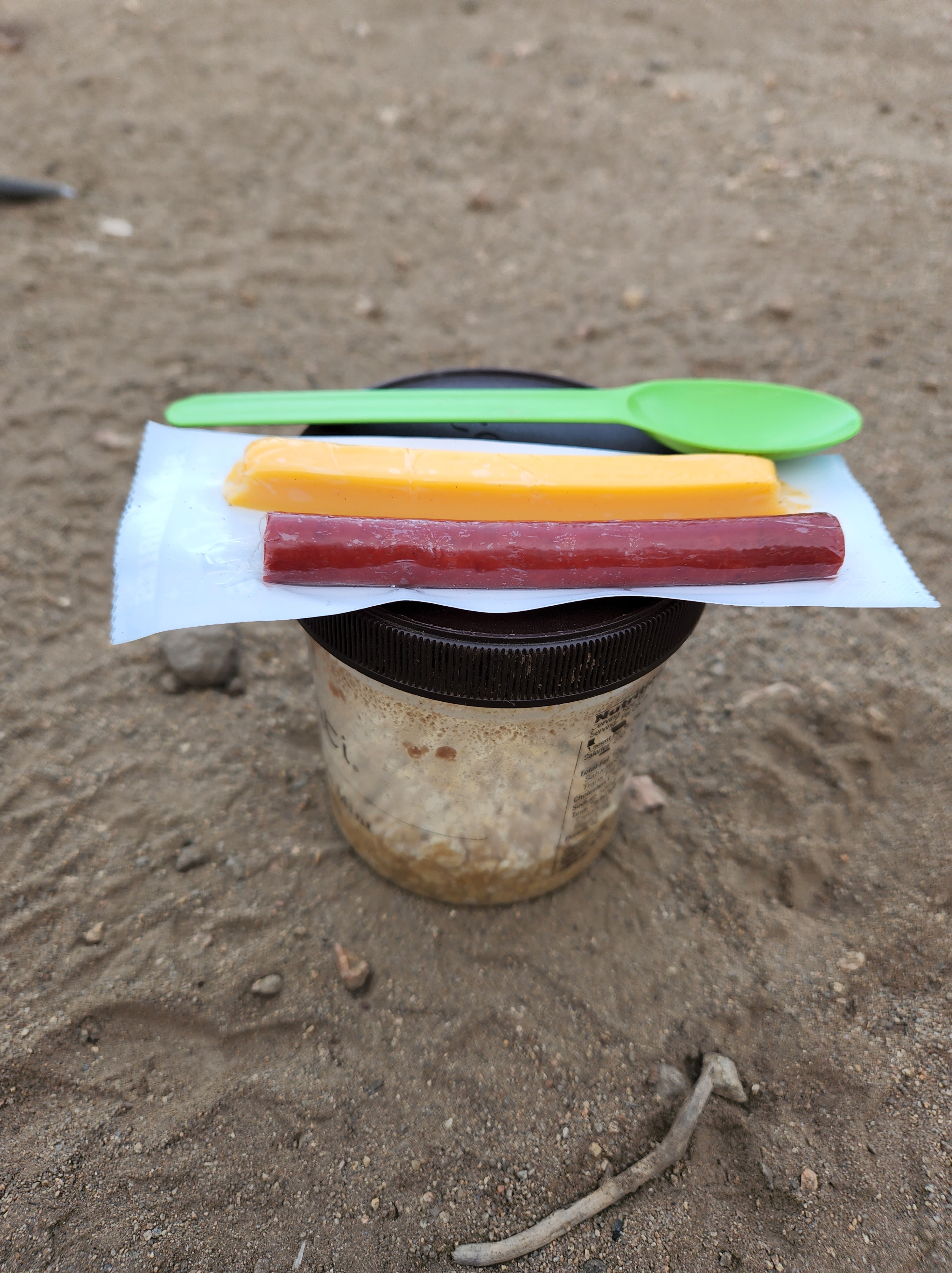
Ten minutes later I’m sitting on the deck of the general store trying to sew this strap back on with dental floss. I reinforced the other one for good measure as it was looking a little suspect. With the chest strap buckle broken as well, I think it’s time for a new pack, but it’d have to wait until the next town. I got all the straps to do their job, I just hope they last.

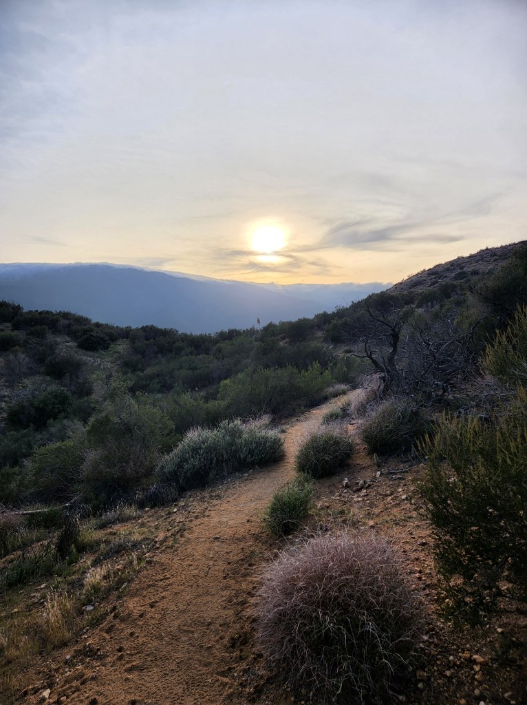
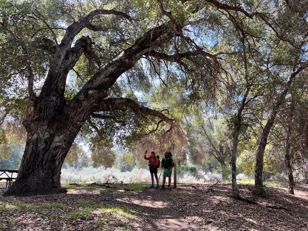
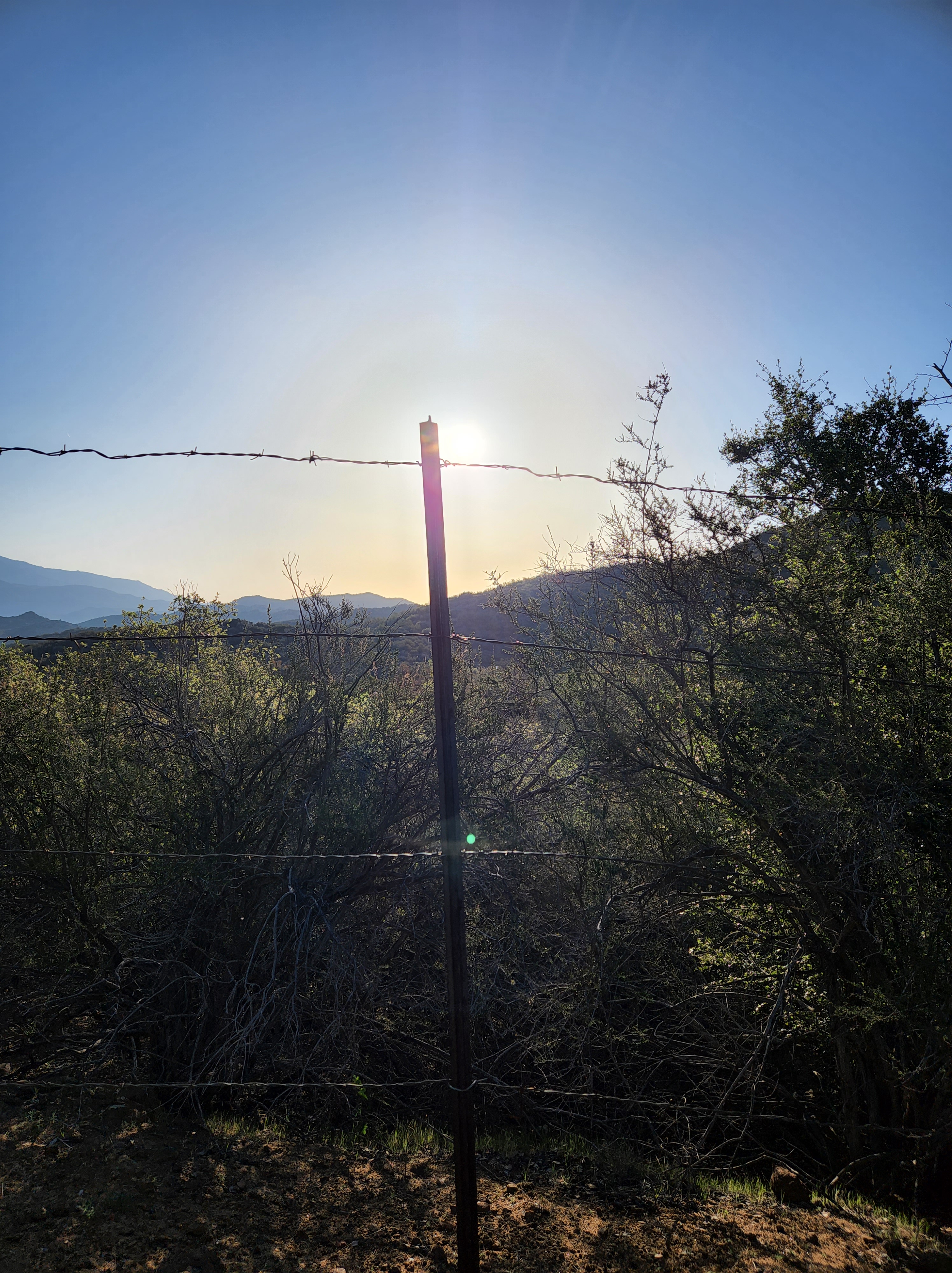
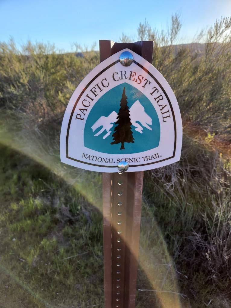
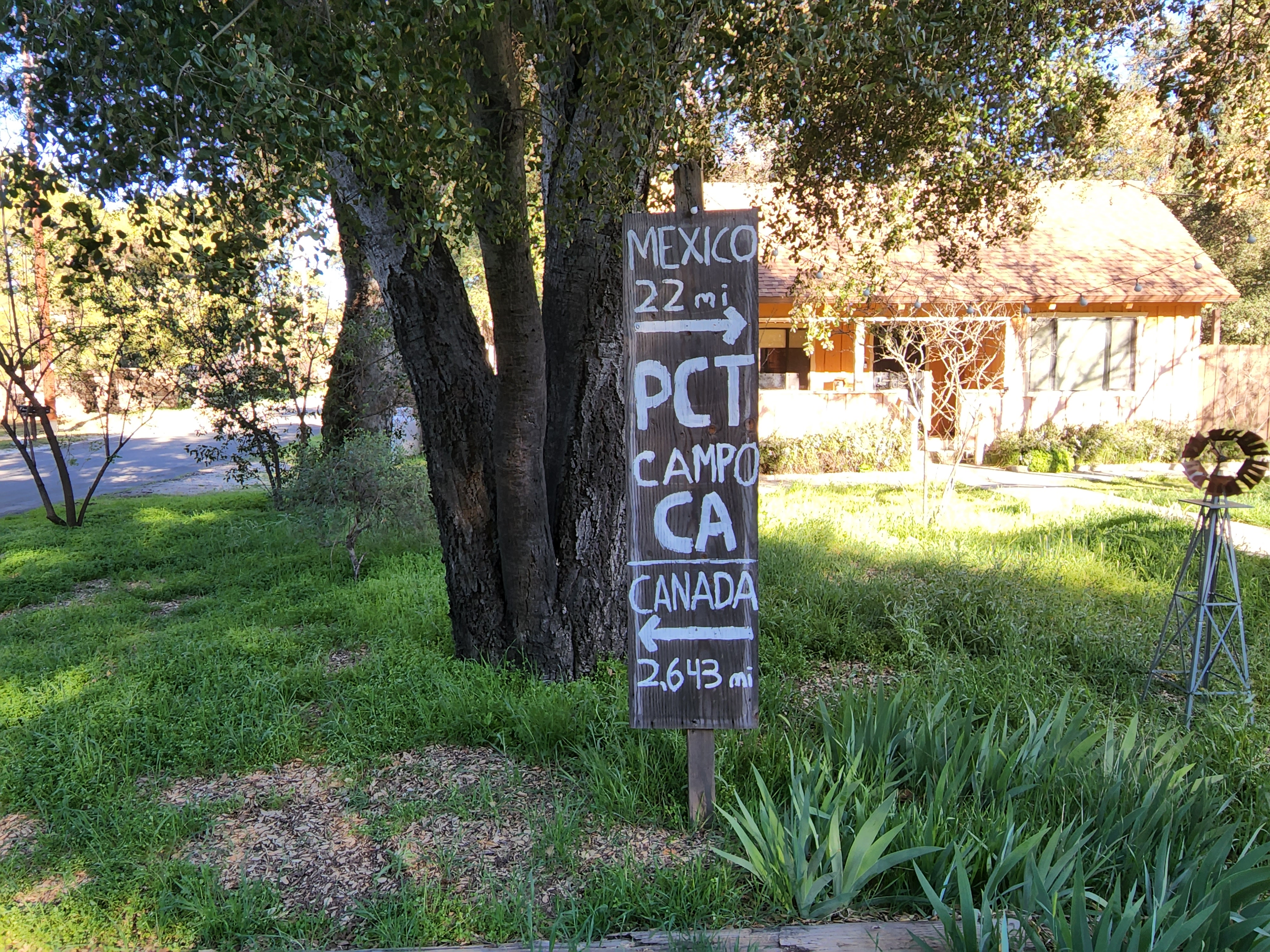
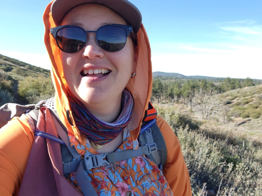
I walked out the parking lot of the General Store and made my way a half mile back to trail. It was still a desert and flat which gave me time to adjust to the new weight of my pack. It sat heavy at my waist as I meandered through the sage and scrub oaks. The trail stopped at an official looking gate and the fanciest trail register I’ve ever seen. I wrote down my name, permit number, and the date for their records. Now its official! Starting the Sierra!

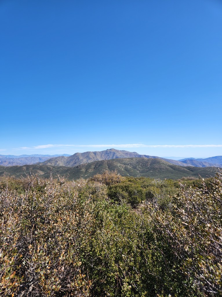
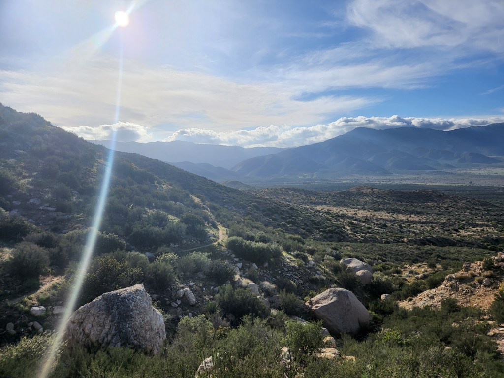
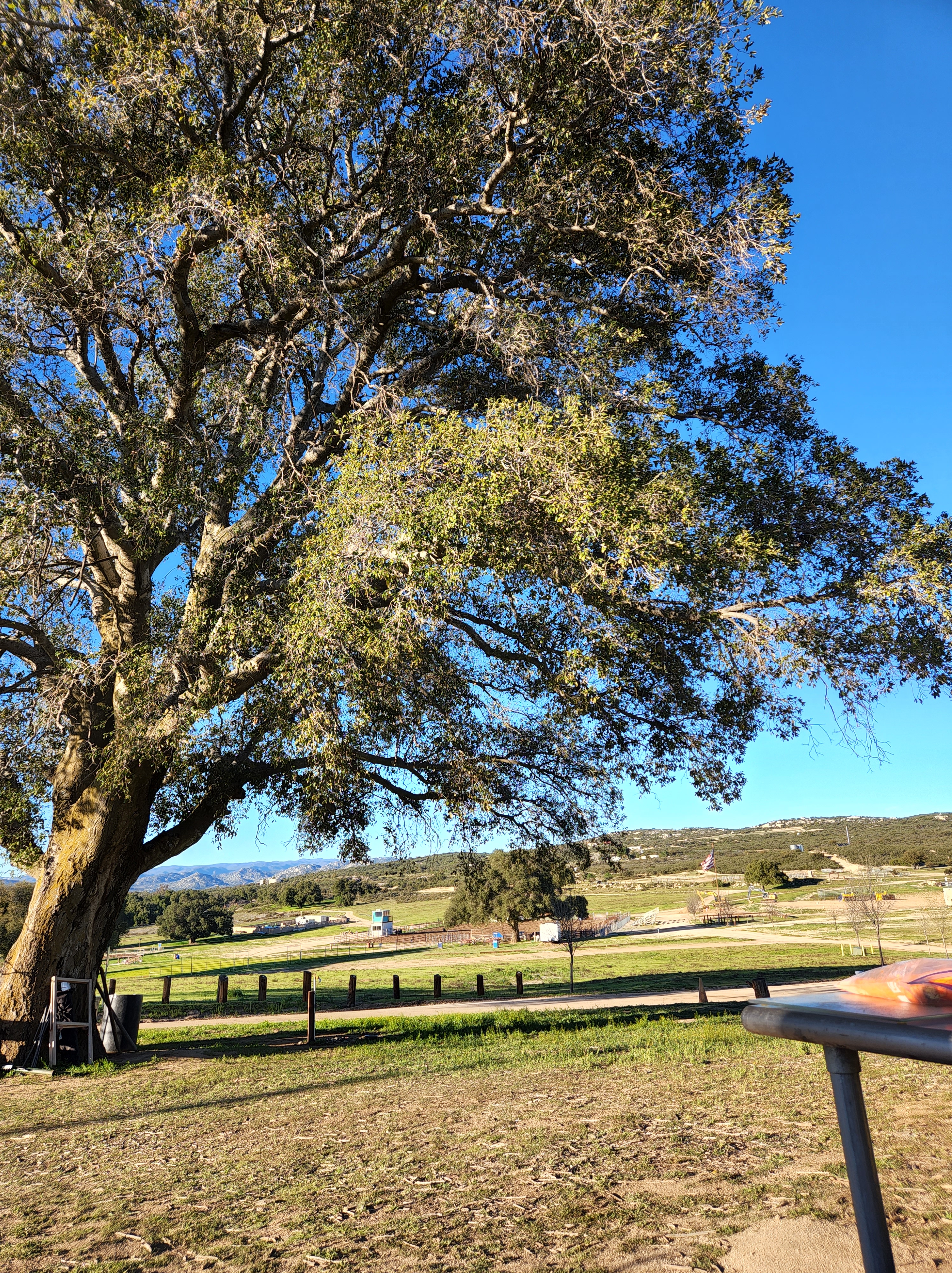
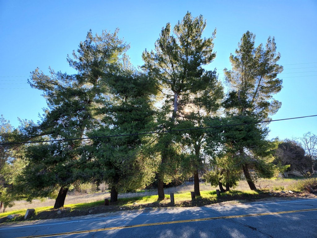
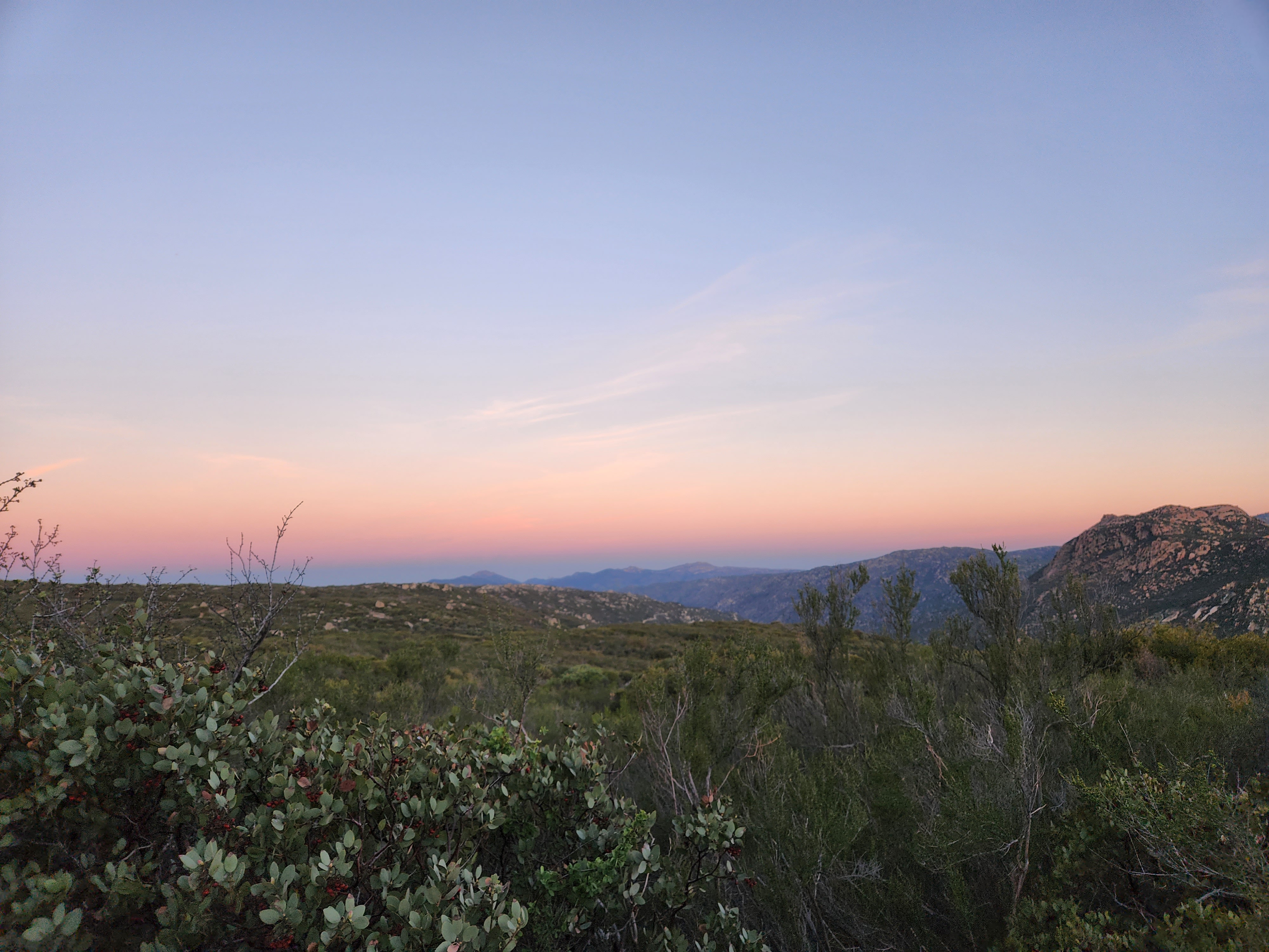
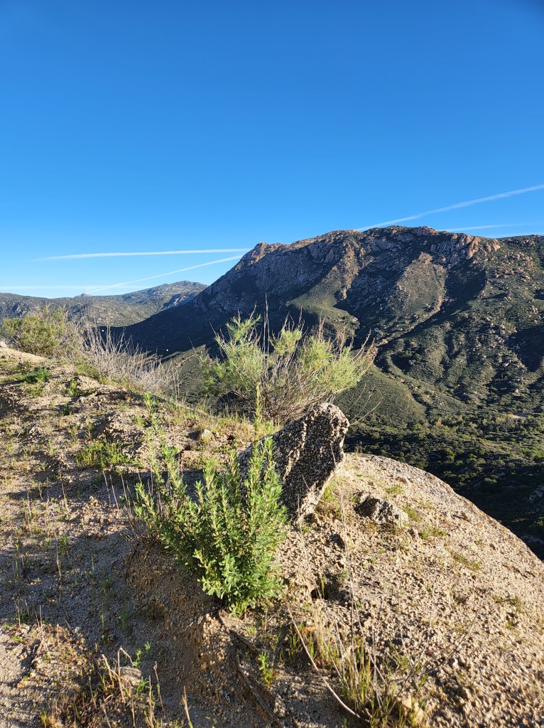
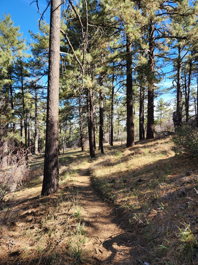
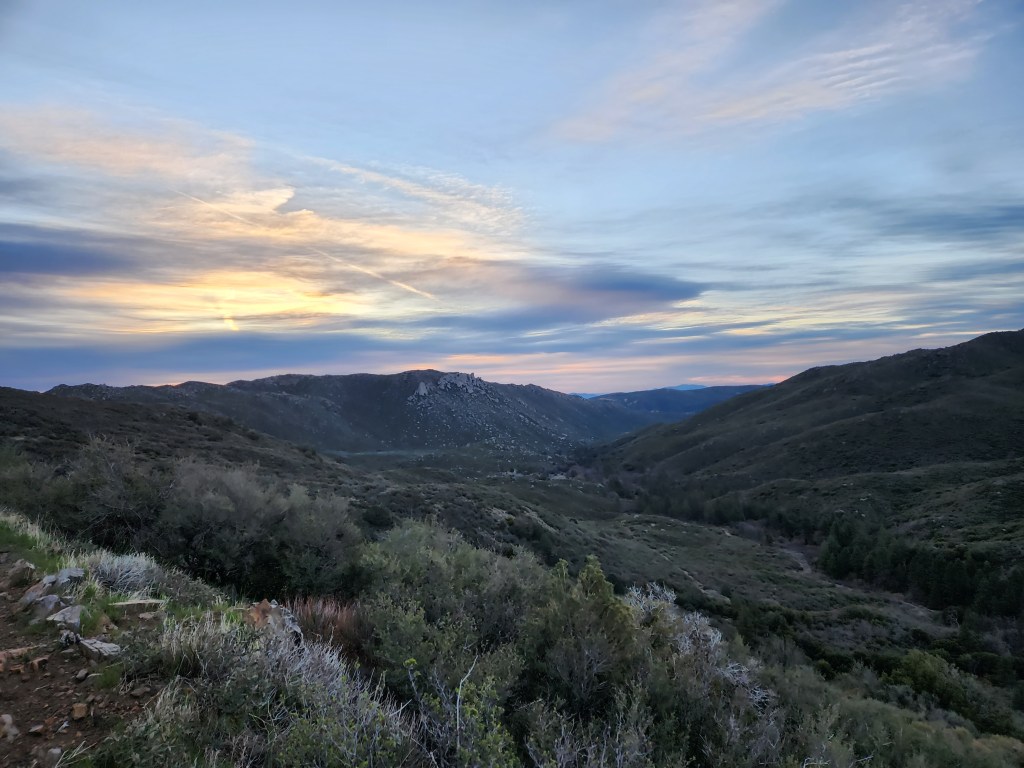
The trail immediately entered a lush pine forest with a creek burbling nearby. A fitting hello. Then is returned to desert/burned landscape that climbed up for awhile. I feel like this was the last desperate gasp of the desert to be noticed and liked. The trail climbed over a pass between two mountains and there lay out in a wide panorama the Sierra mountains. A broad valley of grass opened up the view with the granite peaks bordering the distance.

I was the only one within sight and it felt like I was all alone in the world. But not in a sad way, more an exciting exploratory way. I wandered down the slope into the valley and skirted the grassy meadow. The trail turned back up into the trees and gave me a higher view.

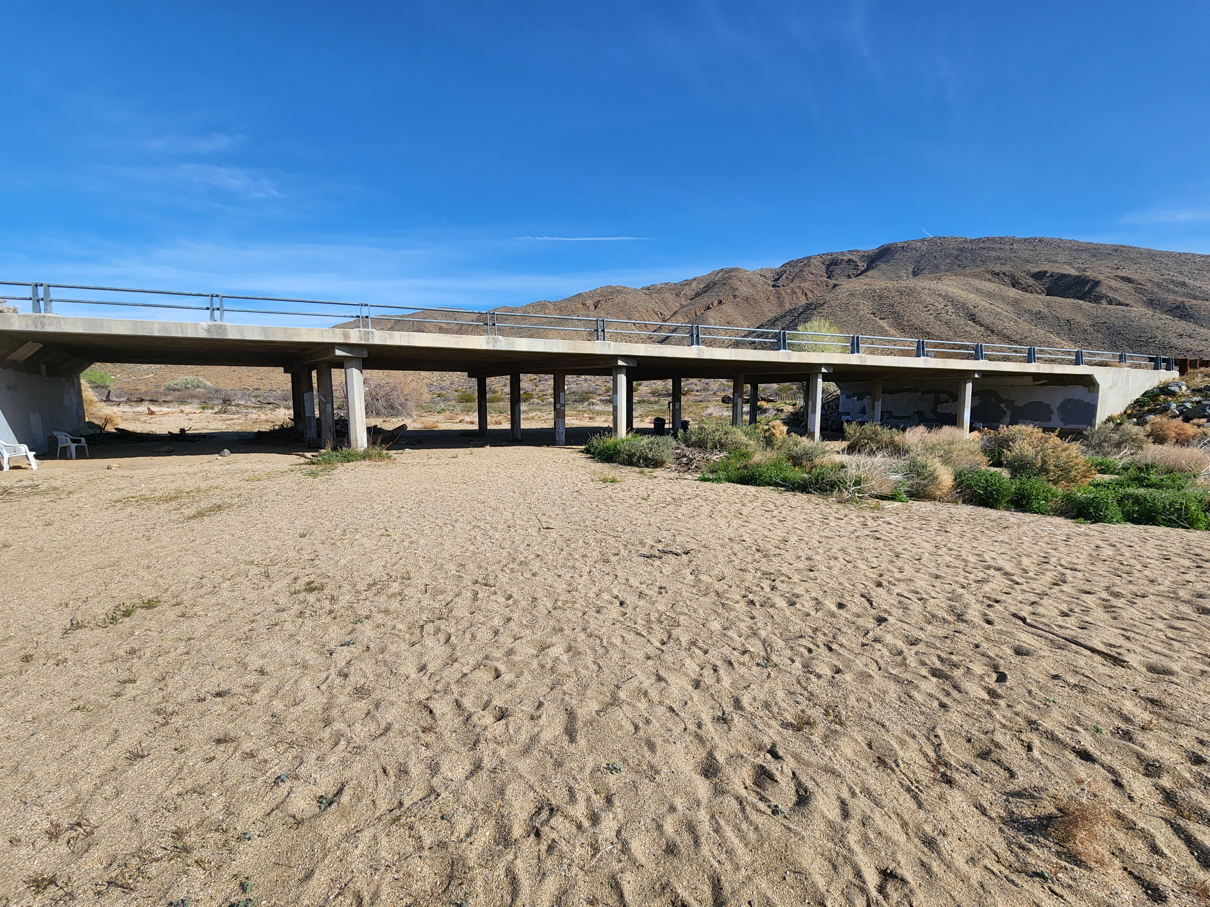
Eventually I made way down to the Kern River (which looked more like a creek to me, but no one asked my opinion) and sat near the bridge for lunch. A colony of swallows had set up camp under the bridge and had continous business flitting about. Their little mud nests became the scene of a war between a marauding Blue Jay and the swallows. I watched as they attacked the offending intruder and drove it off.

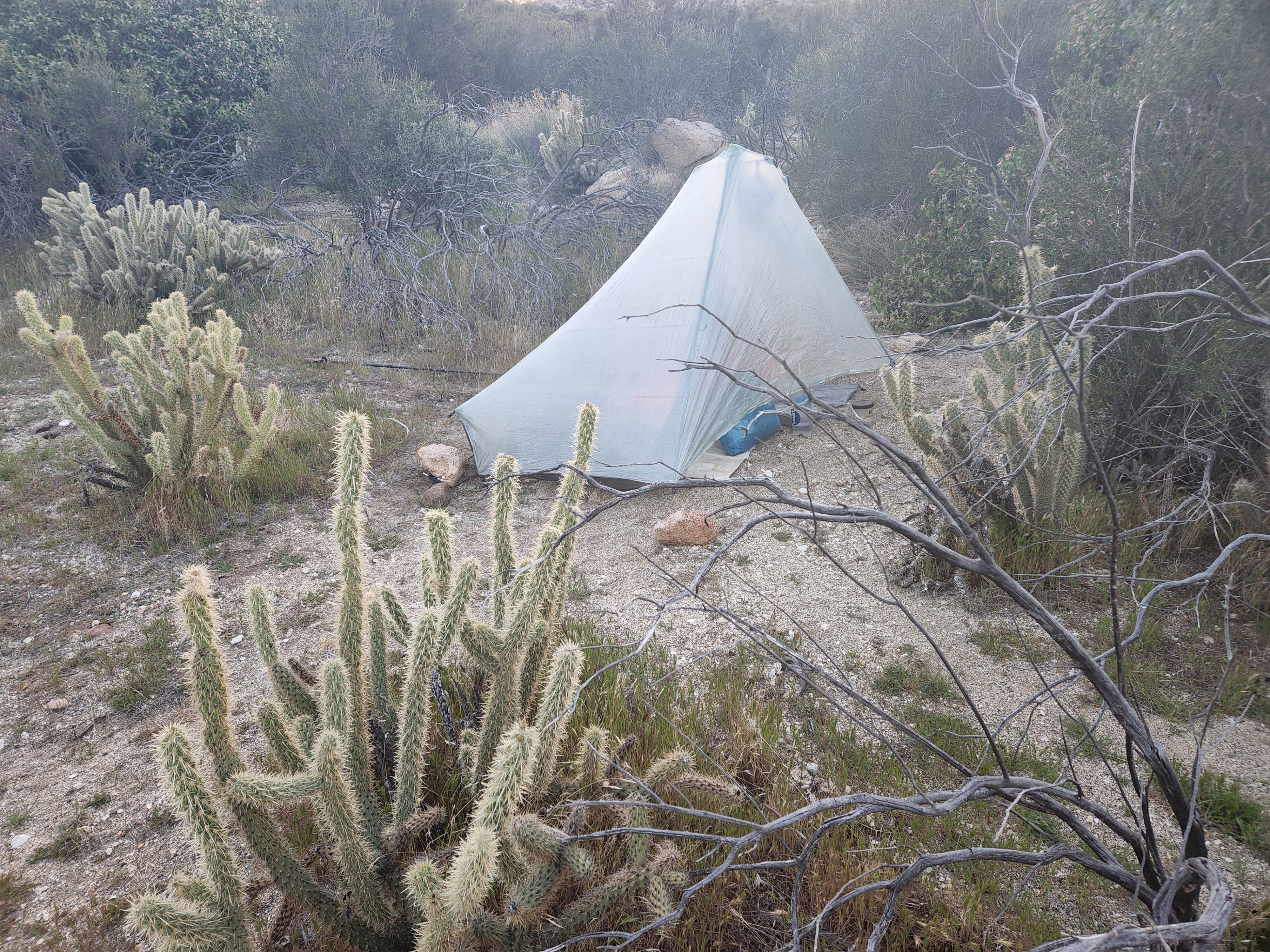
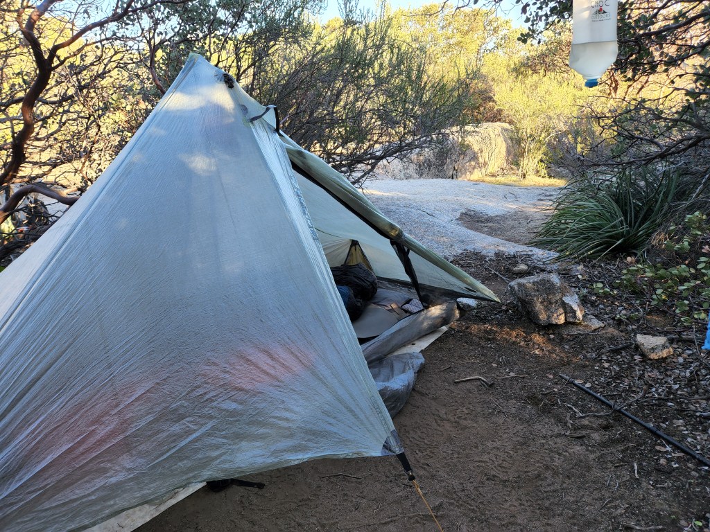
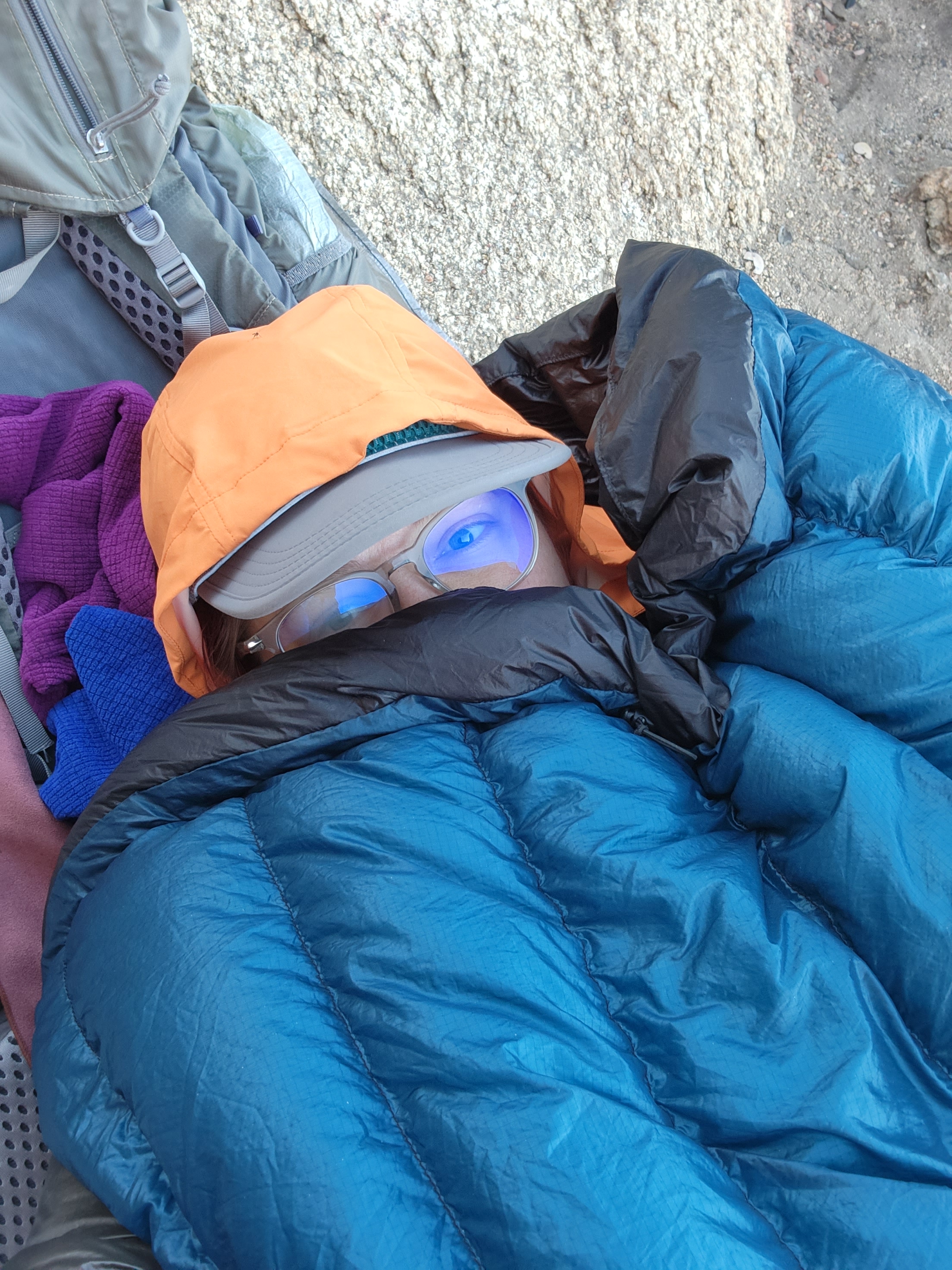
After lunch it was a leisurely climb up next a creek to a higher elevation campsite. I wanted to camp up higher than the creek to start becoming acclimated to the elevation. My experience on San Jacinto had given me some reservations about being up high. I set up in some very tall pines and large boulders. It was already starting to get chilly, but I was prepared. I had my heavyweight wool shirt and sleeping bag liner sent to me at Kennedy Meadows. Also on hand was my stove, so I’d have a hot meal at the end of the day. Tonight’s was Pad Thai. All in all, not a bad start to the Sierra.

Day 60 – 18.7 miles

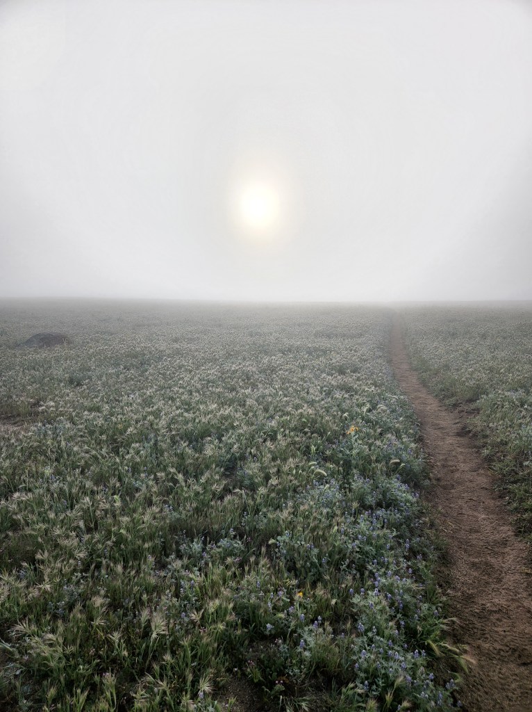
I woke a little early to get a big climb done in the morning. The sun was just rising over a rocky horizon as I reached the higher ridgeline that looked over the valley from the other side. A mist hung low on the ground. The air was frigid and burned my lungs. The rise in elevation wasn’t too bad at this point. I could see the Kern River in the distance looking like a tiny thread, barely discernable.

I crested the mountain and came over to a view of Olanche Peak. The pines and cedars were varied in their kinds and my plant identifying app was no help in learning their specific species. So I started making up their names. There was Long Leaf, White Bark, Red Bark, Long Dangle, Christmas, Brownie Bark, and Fuzzy Branch. I climbed ever so slightly to a large open area with a bunch of downed trees that were perfect for sitting. As I was marveling at all the perfect sitting trees, I realized I was feeling a little loopy and possibly dizzy. I sat on one of my new friends to eat some snacks and drink water. In my enchantment I’d forgotten to keep up with the H20 and calories. It made feel a little better, and not so rapturous about tree seats.

I started climbing down through some sandy fields and boulders. The bright green trees opened up and the sky seemed bluer than usual. I thought about how water can liven up colors and make them seem more vivid as I went to the next water source. It was in the concerningly named Death Canyon. It was yellow, but tasted fine. I ate my lunch there, and since I am still very much alive I don’t think the canyon lived up to its name.

It was a long climb up through more boulders and rocky terrain. The trees offered much needed shade and I actually enjoyed the incline. I also heard a bunch of woodpeckers hard at work. It was a percussive beat to the rhythm of my breath.

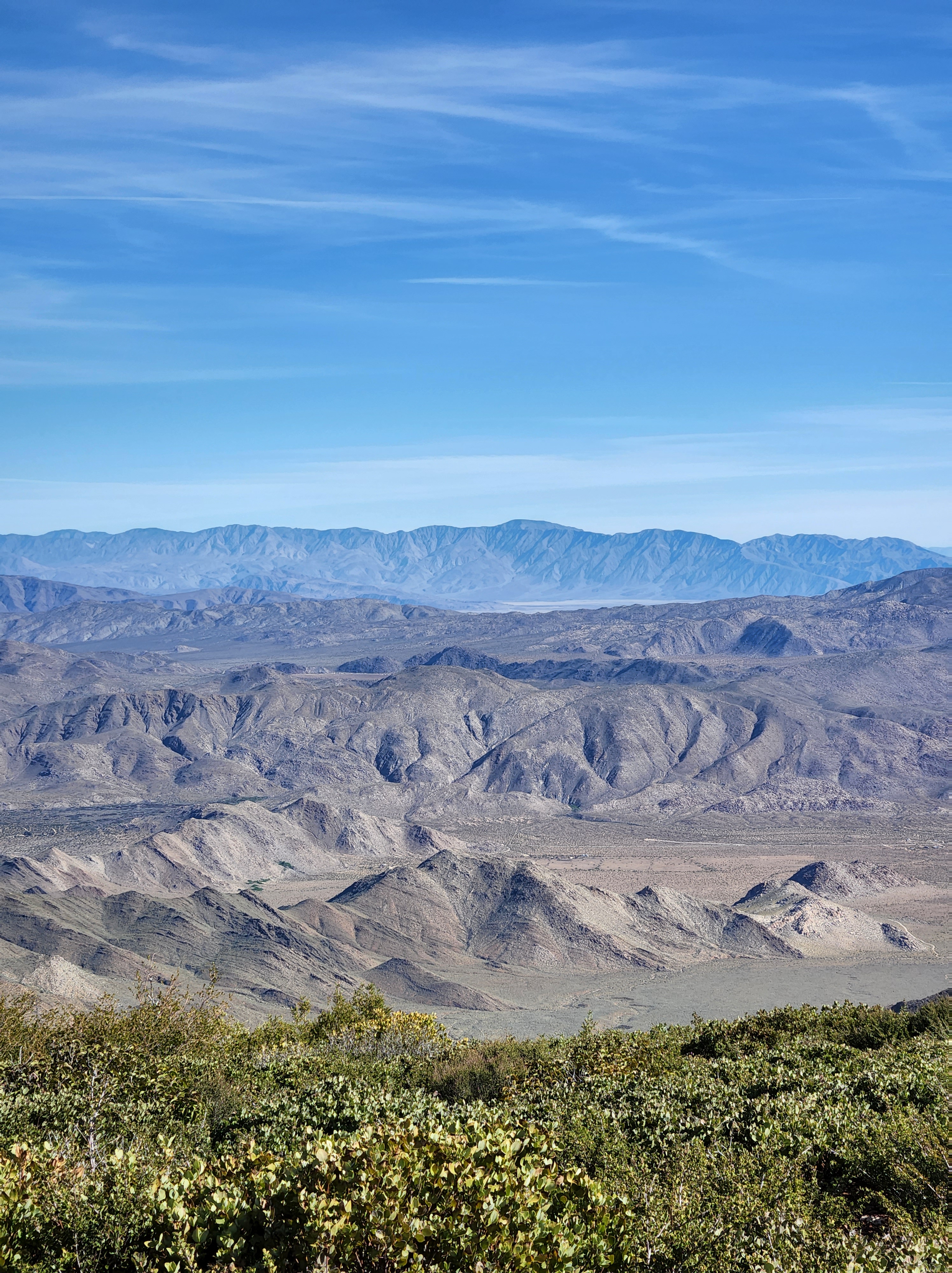
At one point there was a view of Owens Valley to the east. It looked like a large scar of bleached earth. I guess that’s what happens when you cede your water rights to Los Angeles. The alkali flat is all that remains of Owens Lake.

I meandered through the cooling afternoon air to camp. It was a large pine forest with little underbrush and wide open flat spots everywhere. They could have had a festival here and I had the whole place to myself. I rehydrate some Beef Stroganoff (my fav) and got cozy in my tent.

Day 61 – 8.1 miles

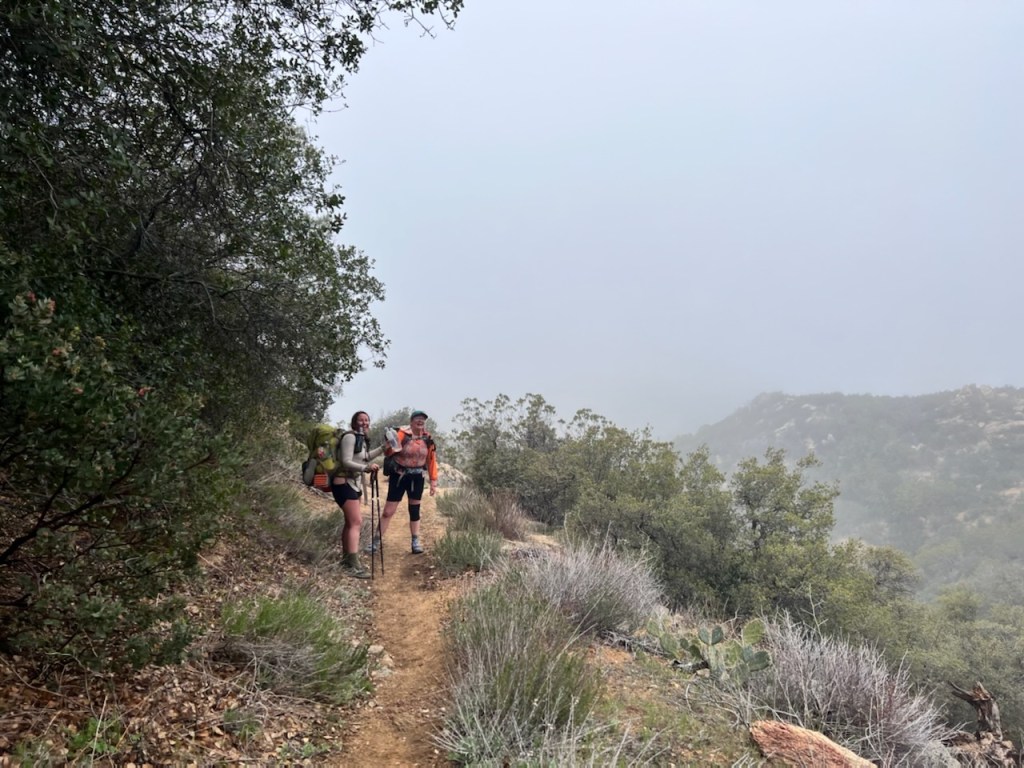
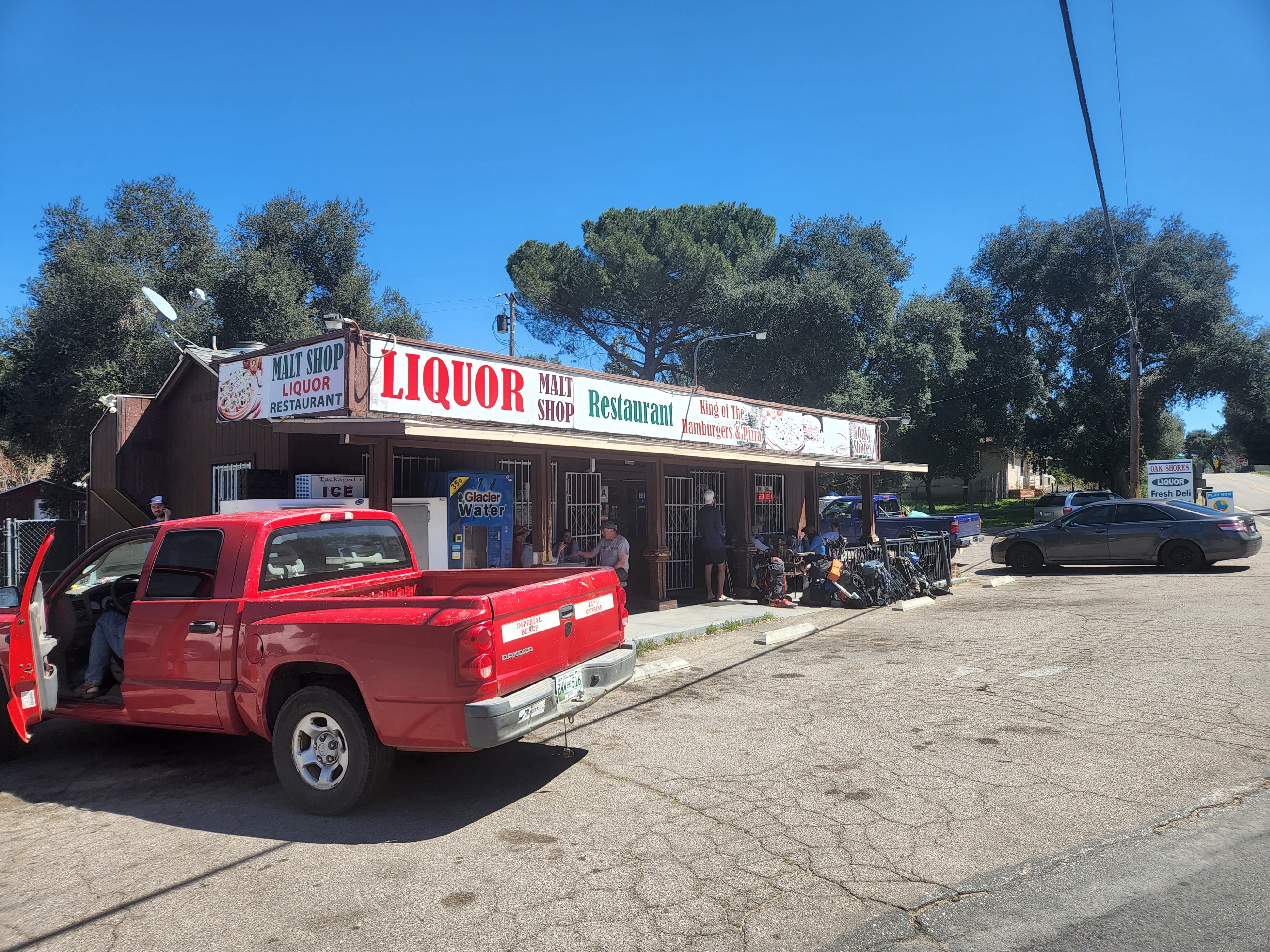
I’d planned to go to Lone Pine so I could pick up a buckle for my chest strap. It meant already getting off trail, which I was kind of regretting. I was really enjoying the trail and it meant breaking up the momentum I had going. But to town I went and it was an easy 5.9 miles down to Trail Pass where I walked another 2.2 miles down to Horseshoe Meadows. I got a hitch from a nice day hiking couple and it was that easy to get to Lone Pine. I don’t think it’ll be that easy all the time. In fact I’m surprised I got a ride so quick from this remote mountain trailhead.

I got to the hotel I was staying at and found out that Bethany and Chris were in Lone Pine! We made plans to meet for breakfast in the morning. In the meantime, I showered (so lovely!), did my laundry (clean clothes!), and went to eat a large sandwich (yum!). I ended the day reading a book in a very comfortable bed.

Day 62 – 0 miles

I met up with B&C for breakfast and got updated on their travails. They are no longer sick, but Bethany is still having issues with fatigue. They going to rest some more and hopefully get back on trail later on. During breakfast I was contacted by Mick the Australian who was in town and he came over.

Not much interesting happens on zero days. Its all arranging, cleaning, and resupplying. And eating and sleeping.

Day 63 – 3.5 miles

It was hard to leave the comfy bed in the morning, but it must be done. Mick and I ate breakfast and tried to find a ride back to trail which proved difficult as usual. We found a shuttle and shared it with a random other hiker we saw on the street.

Getting back to Horseshoe Meadows I really felt the elevation change. I immediately found myself out of breath doing the smallest thing such putting on my pack. I was worried I’d lost the acclimation I’d gained the previous two days on trail. The climb back up to the actual PCT was 3 miles of 1200 feet of elevation gain.

Luckily there were a crap ton of switchbacks to make the steep climb bearable but I still felt quite dizzy and weak the higher we climbed. I made sure to keep drinking water and that helped a little. We got the top and I reveled in being able to do it with relatively fewer stops.

Back on trail it was a short walk over to Chicken Spring Lake where we’d camp. The snow fed lake was surrounded by a wall of mountains that reflected on the water. I went down to get water and immediately got attacked by gnats, so I didn’t sit by the lakes edge too long. It was nice to have a short day and take it slow.

Day 64 – 16.1 miles

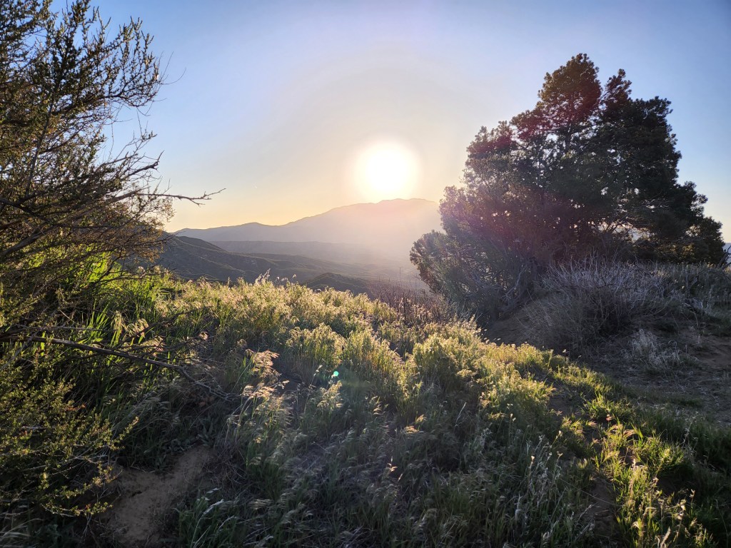
I told Mick that I was going to get up early so I could get some climbing done in the cool of the morning. He is a faster walker so he tends to get up later, but I woke this morning to Mick already to go. It wasn’t cold for once and it was easy to get moving. As we climbed the first hill the sun crested the mountain and spilled over the lake below and filtered through the cedars to the valley on the west side.

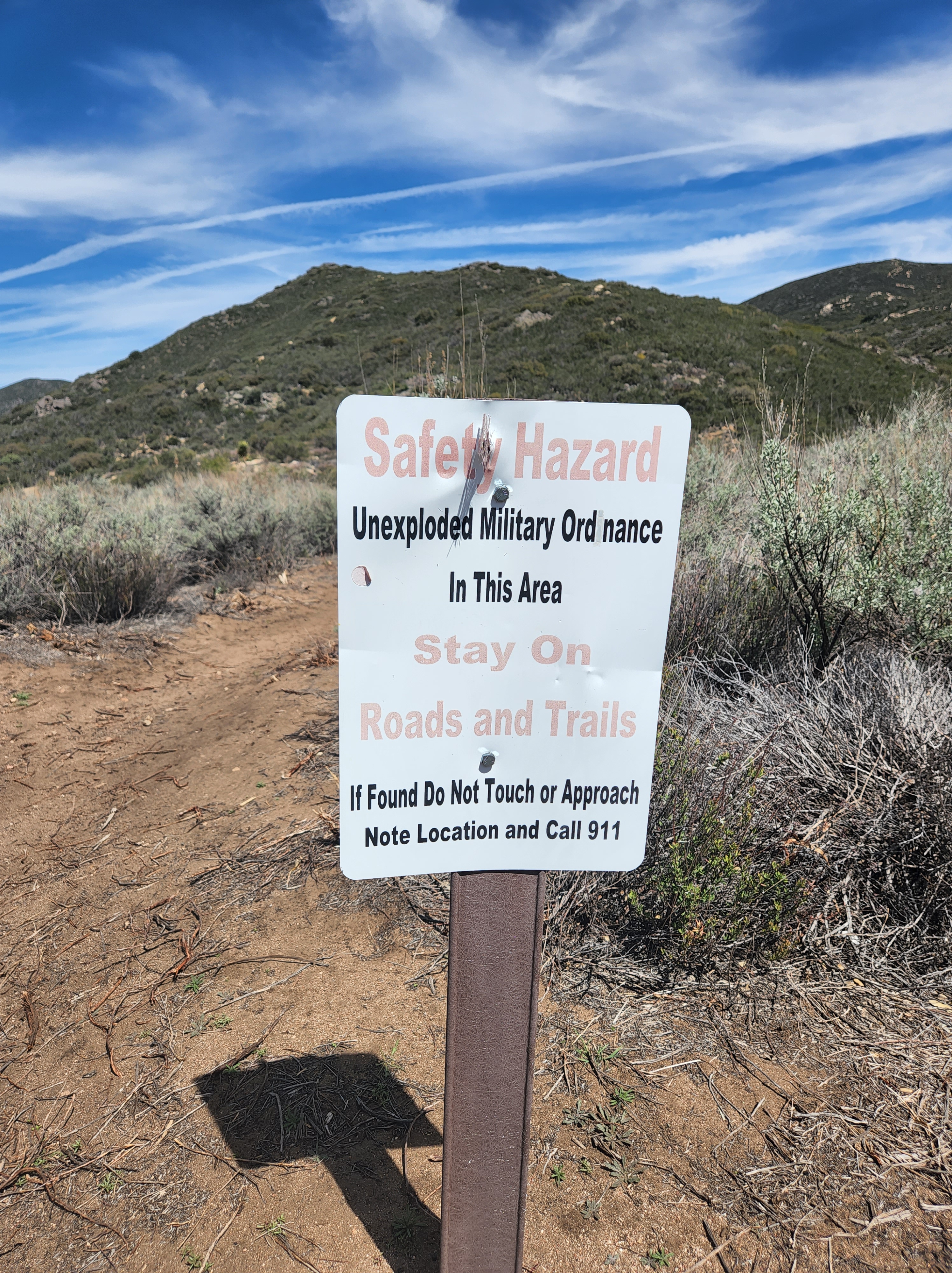
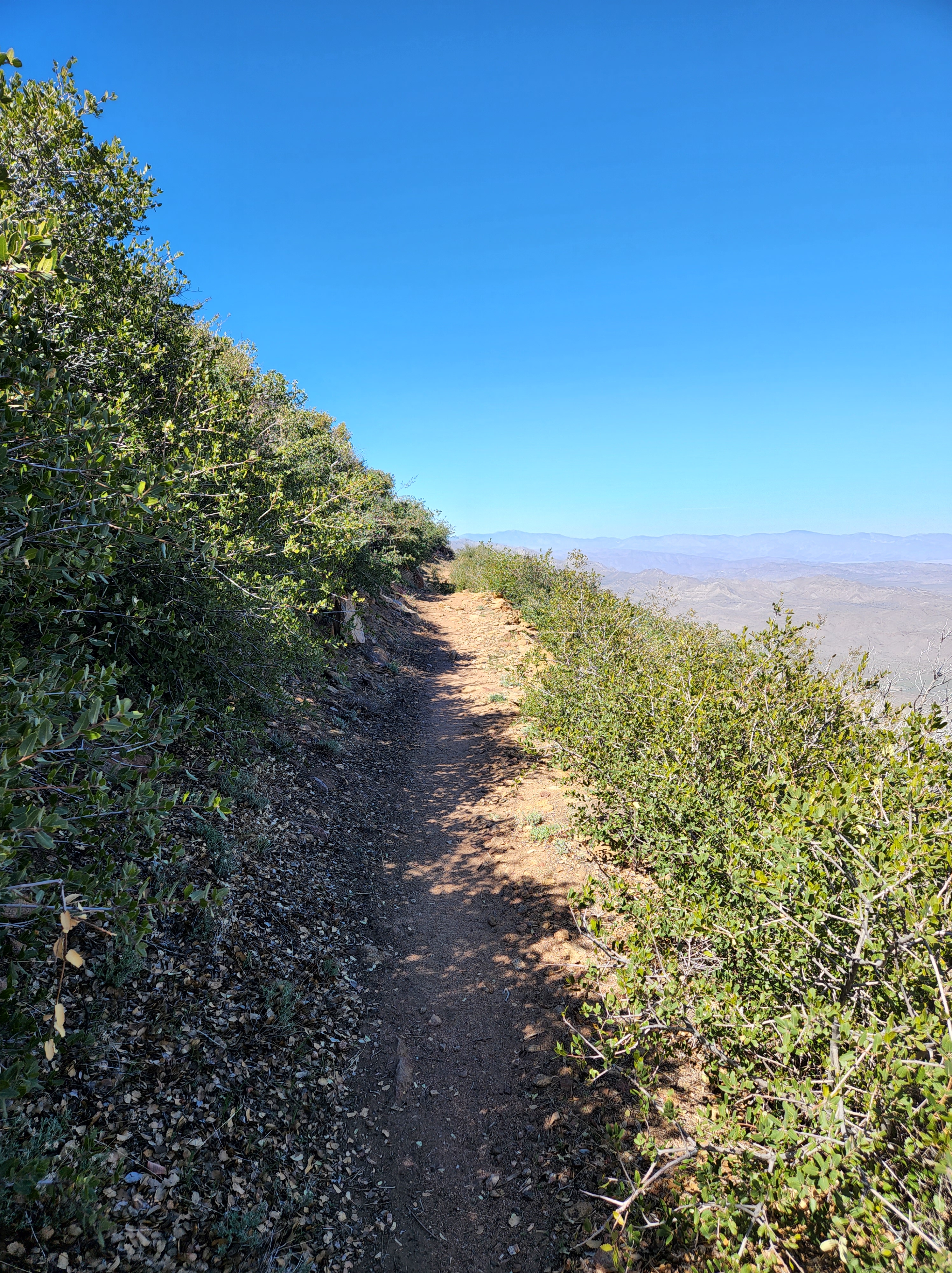
We scrambled up some rocks to sandy trail that wound down the mountain on the north side. At some point we entered the Sequoia-Kings Canyon National Park. It was marked by a sign. There are lots of signs out here for such a wild place. No fires above 10,000 feet. No camping here. No grazing.

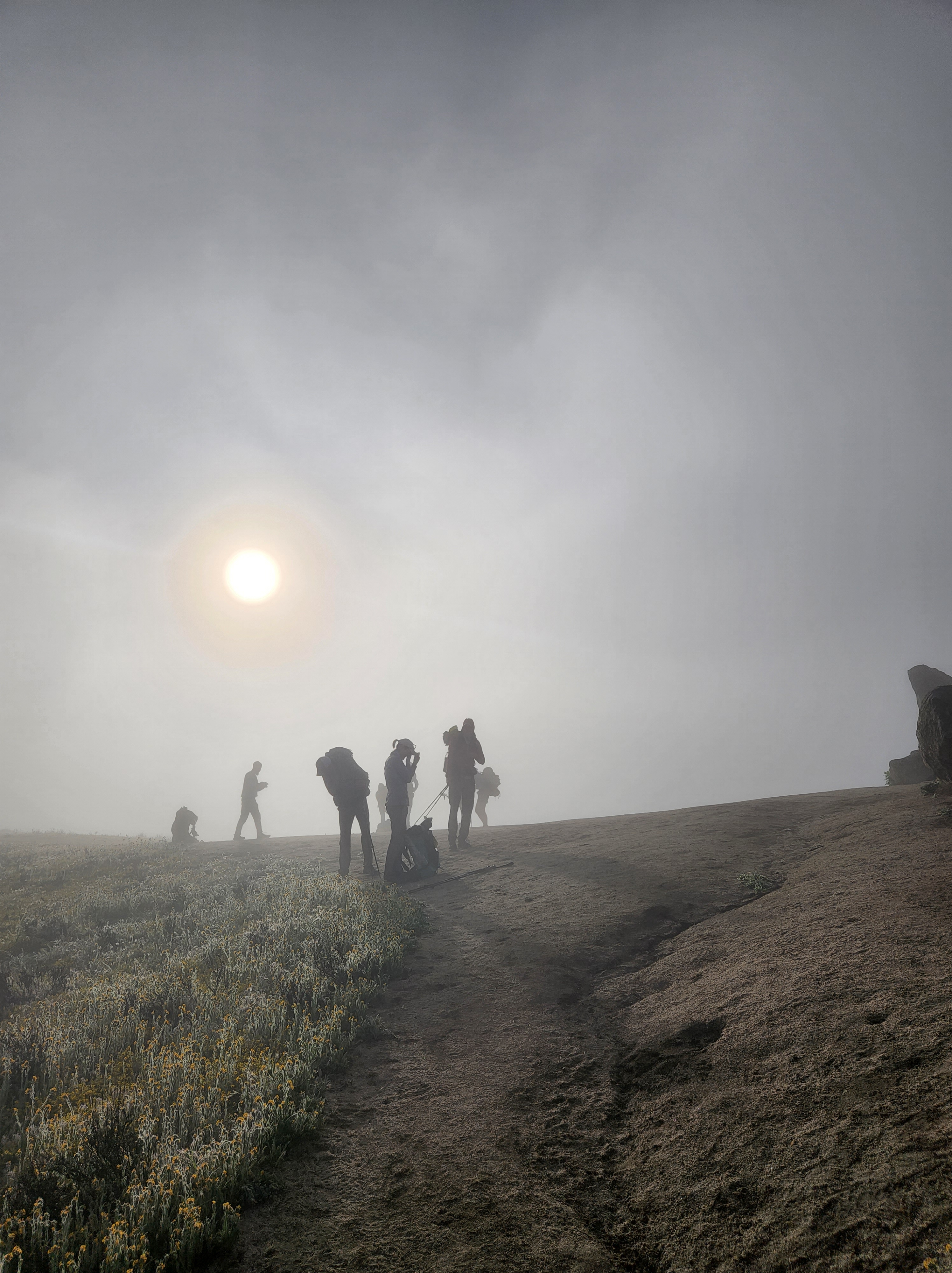
Mick and I ate lunch under a shady pine near a clear-as-glass brook. A continual line of hikers passed us by. I think the hiker bubble has caught up to me. Either I’m that slow or they’re all fired up to get through the Sierra. After I took a nap, it was time to go up. And up. And up.

For some reason, even though it wasn’t all hard terrain I was having great difficulty moving. I figure it’s the elevation? But also I thought after 700 miles in the desert I’d have acquired some amount of stamina. It feels like the first day.

The trail skirted Mt. Guyot which loomed over the little valley I was traversing. It looked even more intimidating with a crown of dark clouds. I didn’t like that. Weather in the Sierra is a volatile and capricious thing. I made like a sloth up another hill and down the next into an open green valley framed by more mountains and a creek running through the middle. This was the turn off to Crabtree Meadows, where we’d be setting up base camp to climb Mt Whitney.

Once at the meadows it was a little village of hikers and tents spread about the forest. It would seem this is a hip-hop-happening place to stay. Most people camp here and wake up early to summit for sunrise (like leave at midnight). I didn’t care for that idea because I knew it’d be unbearably cold above 14000 feet before the sun rose. But I also didn’t want to do the climb in direct sun. So the plan is to leave at 0400.

Day 65 – 16.2 miles

Mt Whitney isn’t on the PCT. It’s a 8 mile side trip, 16 round-trip of non-trail miles. It is usually hiked though because Mt Whitney is the tallest mountain in the contiguous US. So it’s kind of a big deal. I’m no peak bagger, but I figure this is probably my only chance to hike something so epic. You can leave most of your stuff in your tent at Crabtree Meadows to make the climb up easier.

I was able to get walking by 0430 and the moon was still hanging over the eastern mountains. Mick was following behind and we made our way forward by the light of our headlamps. The trails goes by some lovely lakes and with the sun rising made for a dramatic start to the day. The line of the sun rising on the western mountains started to get lower and lower.

We finally made it the start of the wall of climbing. By this point I was already worn out and I told Mick who is way faster to go ahead of me. The never ending switchbacks were steep. Every five feet I had to stop and catch my breath. My pace slowed to a crawl.

All the people who had gone up for the sunrise were starting to come down. Apparently my face was saying something because everyone kept asking me if I was okay and did I need help? At first I was bewildered. I was slow and out of breath but didn’t feel like I was in danger. After all the condescending concern though, I got weepy which only made my breathing worse. So I decided to get mad instead and hate hiked for a long while. People stopped asking after my condition.

The view all the way up was an increasingly distant valley of lakes glittering in the sun. I got to a level where the whole mountain range opened up in all directions and they sky was clear enough to see for miles. I got to the junction where the trail actually starts up Whitney. It was the longest 1.9 miles ever. Now added to the difficulty was rock scrambling and sheer drop offs very close to loose scree. It took another hour and half to muck through all that.

I finally reached the top around 1100 and honestly, was too wrecked to fully appreciate the accomplishment and view for awhile. I got my pictures taken and then sat down to rest and eat. It finally hit me that I was the highest (heh) I’d ever been on my own power. The dome of the sky looked even more curved with 360 views. At that elevation there wasn’t much noise other than humans and a low hum. My breathing slowed and I began to feel a deep calm. I sat there a long while just enjoying the view blue glow over the horizon of mountains.

What goes up must come down though. Mick and I started to the walk aback down around 1300 and it was definitely quicker than going up. It was kind of boring though. I was able to amuse myself by playing the Spot-the-Fighter-Jet game. Ever since the end of the desert I’d been hearing these jets fly over but never able to actually see them. It became a personal challenge to find them in the sky. Up until today my record was two. I don’t know if it was the elevation or Whitney is on some special flight route, but I was able to spot ten (10!) fighter jets! A special record.

Once we got back down the valley it was a more pleasant walk. The lakes were more inviting in the daylight. As we rounded a corner about to cross a stream, I saw two fat marmots digging in the dirt and promptly freaked out. I’d been wanted to see a marmot. They let me get really close to take a picture and seemed to care little that I was even there.

The rest of the walk was a breeze and I got the see what I missed in the early morning darkness. We made it back to camp to find even more tents popped up around the meadow. I ate a quick dinner and laid out in exhaustion.

You are the sovereign of all you survey when you sit on this throne.

Day 66 – 8ish miles

Got to sleep in this morning because the plan was to have a short day in preparation for Forester Pass. I woke up feeling hung over: headache, nausea, and very sore. I couldn’t lay there all morning though and once I got moving I felt better.

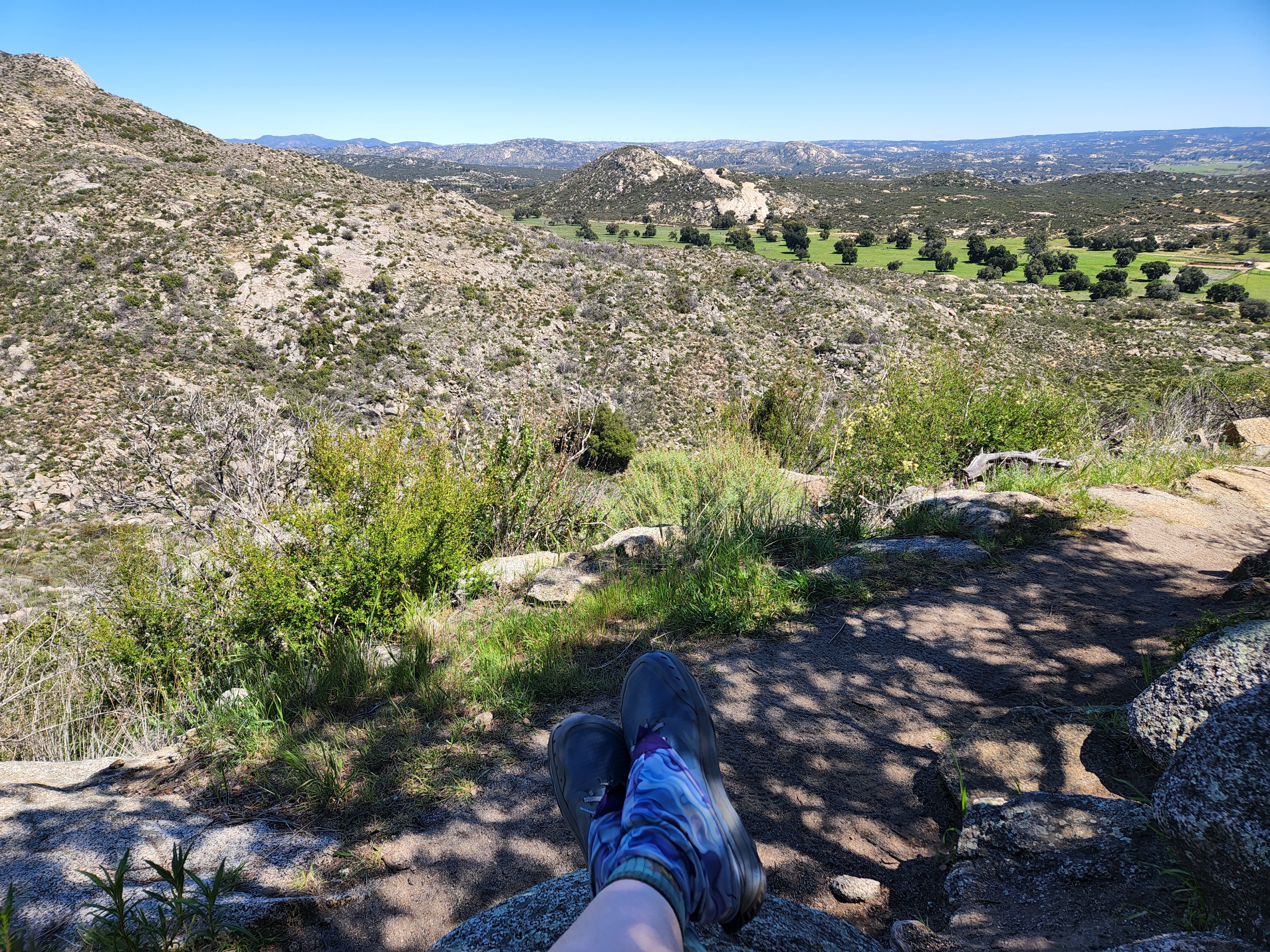
The trail was mild and varied. Beautiful views of austere mountains to the west through grass meadows and forested yet sandy valleys to the east. Camp was a rocky area next to a creek that drained from a lake. I decided to cowboy camp in order to get going earlier in the morning.

Day 67- 22 miles

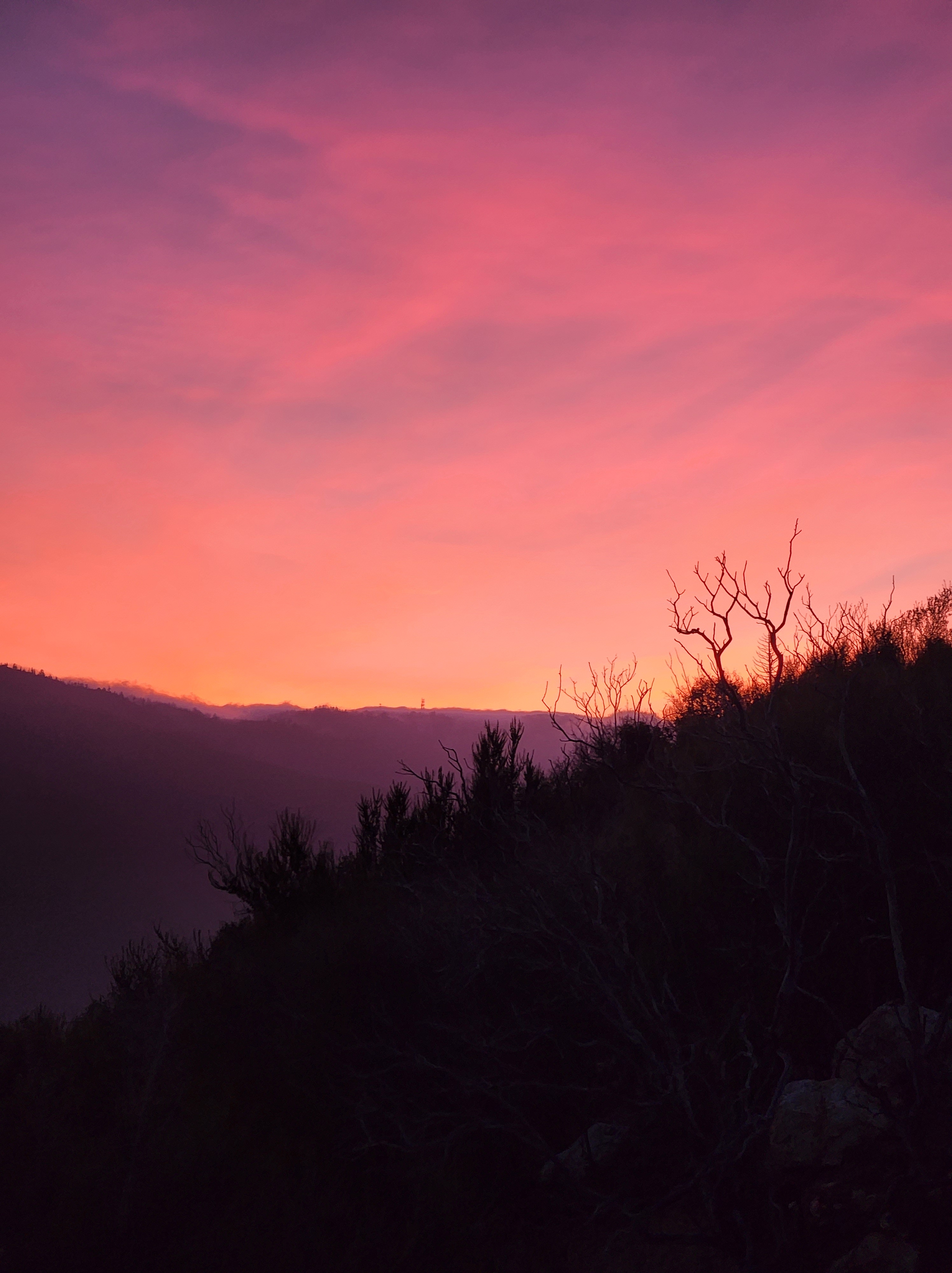
My plan to cowboy camp backfired as I didn’t want to leave my sleeping quilt due to the cold. I got going by 0450 though. Mick said he was going to leave later. After crossing a freezing creek I walked into a wide open valley with the sun rising behind the eastern mountain range. There were some clouds so it made the colors bright and gorgeous. I kept stopping to take pictures which slowed me down a little.

I climbed up through a exposed and rocky hillside to the beginning of the climb. Wind and clouds were blowing in at a rapid pace. It started spitting rain and and as I kept walking it turned into flurries.

The reason you want to do a mountain pass in the Sierra so early in the morning is because of the snow melting and becoming slushy and unstable. Adding this weather to the fact that I was climbing the highest point on the PCT gave me some reservations. Forester pass sits at 13120 ft and it was socked in by clouds. No one else seemed concerned about this. But also where else was I going to go? I kept going and the wind and snow seemed to lessen as I approached the wall of switchbacks up to the pass.

I started up slowly, once again stopping every 5 feet. The sheer cliff of the trail and wild weather kept me thinking why the hell am I doing this again? But I made it to the top and the weather calmed on the north side. Congrats and pictures were had and then it was the beginning of the descent.

The entire north side of the mountain was still very much covered in snow. Because it was still early it was also crunchy and easier to navigate. I put on my microspikes and began the slow and careful process of measuring every step.

At one point there was an opportunity to glissade down a ways. A few people had already gone creating a chute. I secured my stuff in my pack and placed my trekking poles to the side to use as steering of sorts. It was fast, scary, and uncontrollable. Half way down was a rock that wasn’t visible from above. The chute also got a little pinball-esque right before it and I lost my poles from all the jerking around. Somehow I flipped on my left side and slid over the rock coming to a stop. I didn’t feel immediately hurt, just thrilled by the ride. I recovered my poles, but decided perhaps glissading wasn’t for me when my left hip started to ache.

The rest of the descent was a careful foot placement and occasional post hole, and I made down to the valley without incident. It was still windy and spitting rain which worried me a bit. I started walking in Kings Canyon proper and the walls loomed menacingly above. I’m sure the weather was influencing my views.

There is a group I’ve been bouncing around for awhile now and they mentioned trying to get Bishop earlier than planned and it sounded good to me. I’d been going slow in the hopes to avoid Memorial day crowds, but the intense weather changed my mind, so I hitched my wagon to their train and decided to do the Kearsarge pass trail out to town. It meant more climbing late in the day, but this pass was completely snow free.

The climb started and my left chest (lung or rib?) started to ache pretty badly. It slowed me down further. I think I might have bruised something in that glissade. There was nothing to do for it though, but keep walking.

More beautiful views, more lakes, more glorious trail. But I was hurting and beginning to get gripey. The wind on Kearsarge pass was somehow even more blasting and colder, so I started shuffle jogging down. It was not pleasant.

I followed the group down to the campground and found a spot to hide away in. I laid down, took some ibuprofen, and fell right asleep. I was wrecked.

Day 68 – 0 miles

I woke feeling like hammered poop. My entire left side felt like it took a couple of rounds with a baseball bat. I managed to get moving though and joined Moonpie, Kat, and Genna in finding a ride to Bishop.

We got to town and I tagged along as the awkward plus one. They’re letting me stay with them in an airbnb. Due to the holiday and the Mule Days Festival in Bishop it’s really hard to find accommodations.

I’m hoping this bruising pain will get better soon. Also I’m dealing with shipping issues with a new pack. My old one is falling apart at the seams, literally. I might be here awhile.

The PCT – Desert Sec – Days 43 – 58

Days 43 & 44: 24.9 miles

Hiker Town is an interesting place. Located right next to the trail, it functions as a way station before the long hot LA Aquaduct section. It’s amenities are water and shade which are no small things in this part. The facades make it look like an old timey western town and if you were to stay here you’d possibly sleep in such renowned places as the City Hall, the Flower Shop, or Circus Casino. I slept in the Casa De Villalobos. That’s all you’ll be doing in there too as each room is literally just a bed with no electricity or water. There are outdoor outlets at the main building and an outdoor shower. For 25 dollars I was able to shower and sleep in a clean flat bed. I washed my clothes in a washboard sink and utilized the intense sun for once to quickly dry them. The gas station market down the road will come pick you up and in fact had been making hourly shuttles. The Filipino family that runs it cooks a mean burger and I was able to supplement my snacks with Mexican candies. Martha, the caretaker, makes tamales at 1730 and you can have you fill of cheese, vegetable, or chicken.

Well technically I did all that yesterday. Today I was waiting around until around 1800 to leave and night hike the LA Aquaduct. The atmosphere during the day at this place is one of lazy somnolence. People who aren’t staying the night can lounge under the gazebo and large oak until ready to leave. I’ve heard it said from multiple sources that this place is “sketchy” and a “dirty shithole”. (Side note: what does a clean shithole look like?)

For a place that caters to hikers I’d say they’re doing pretty well and Martha is just the sweetest. I think people have high expectations for trail stops and yeah, Hiker Town might be a little dusty and run down, but it’s also not supposed to be a high end hotel either. I can see how if non desirable company were to show up it would be uncomfortable but I feel like Martha would be quick on that.

Anyways this isn’t an ad for Hiker Town, but it irked me that people were bad mouthing the place. I thought Bethany and Chris were up ahead in a hotel in Tehachapi sick with some sort of sinus infection (?) But it turns out they were actually in Palmdale and chose today to return to trail which meant getting on at Hiker Town. The band was back together! Well kind of. They were still feeling sick and stayed at a hotel for the past 3 days. They were concerned they might have Covid but their symptoms didn’t really line up with that, from what they told me. They said they were feeling better but to look at them you’d wonder what bad looks like.

My shoes showed up so I had some fresh foam under my feet for the tough section ahead. The LA Aquaduct was birthed in 1913 and diverts water from the Sierra to Los Angeles for irrigation and such. The walk along this area is very exposed, flat, and reported to be grueling in the daytime. At 1730 I started getting ready and the temperature began to cool. We headed out into the golden hour as one of the first of a herd of hikers to follow.

The aquaduct started out as an open air concrete river with ducks splashing around. A disappointedly short walk, as the water glowed blue and just screamed for a swim. The signs near it though warned of drowning and to stay out. We turned left towards the mountains and then began the longer pipe walk. This is the more famous part of the aquaduct as the riveted iron makes for a likable Instagram post. It is fun to walk on for about 5 minutes and then the pointed rivets begin to tear up your feet. There is a dirt road next to it that provides relief but also blocks the sunset out west. When the colors began to change in earnest as dusk fell, we got back up on the pipe to fully enjoy the show mother nature put on. The pink turned from a soft bubblegum to a vivid fuschia to an intense magenta. Cameras could never capture the experience of the human eye, even though I tried. It kept evolving and a jet flew through the cerise sky leaving behind rouged contrails. A cresent moon began to glow across the gradient of an ever dimming dome of coral to midnight blue.

The breeze kicked up and the trail turned east onto a dirt road with a concrete slab. The stars came out twinkling and the ambient light of the towns in the distance was enough to walk for awhile. About a mile into this B&C stopped with exhaustion and said they weren’t feeling well so they were going to turn back. I kept going on alone and by this time the herd of hikers had passed me by. It didn’t matter though, the calm of the night had settled and I actually felt energized and excited. I clicked on my headlamp and a podcast and cruised. I found out that I love night hiking.

The only thing that creeped me out was a large cross in the distance that was lit up like it was made of neon lights. Everytime I glanced over to the right it was large and in the same spot. As I went down the trail it seemed to follow me, as in it didn’t fall back. Five, ten miles down it was still in the same spot. Eventually I turned north off the easterly trail and started climbing and at the top when I turned around it was Still. In. The. Same. Spot. Logically I know it was something to do with light and perspective being distorted at night but it still freaked me out a little.

Around midnight I took a small break on a concrete slab and was surprised to realize I’d already walked 14 miles. I felt I could go on and did. Around 0200 I began to walk into a wind farm and realized I should probably stop for a longer break before the real wind started. I searched out among the brush next to the trail and found a flat spot that I cowboy camped on. I was lulled to sleep by the constant whirring of the wind turbines above me.

I was wakened at 0530 by some hikers passing by and felt I should get going as I would be in direct sunlight soon. As I entered the wind farm proper the blasts and gusts would literally suck the air out of me as they punched me in the lungs. The trail began to snake up and down through some small hills. Walking out of the farm I began a climb up into the blinding sunlight only to go back down into Tylerhorse Canyon. There were two very large shade trees down a ways and I promptly set up my sleeping system to wait out a large block of the day and nap. Apparently a lot of others had the same idea because I woke up there were four others around me.

I got going again by 1600 which began a long 7 mile climb up a large mountain with a million switchbacks. At each corner the horizon lengthened and I could see the miles I’d already traversed. The closer to the top the wind picked up with a force. I began to lose energy quickly but picked up my steps to camp. Finally made it to my planned stopping point around 2030 and laid out cowboy style again. This time the lights of Mojave twinkling out down the mountain were the last thing I saw before I fell asleep.

Trail marker at the shower
New shoes!

Day 46 – 48: 8.8 miles and two zeros

I woke up frequently through the night because the wind blasts would lift my sleeping quilt off of me and try to fling it down the mountain with me in it. Luckily it was strapped to my sleeping pad and wasn’t going anywhere but still it a was disconcerting way to be startled awake. I gave up trying to sleep around 0500 and just started to getting ready.

I could smell rain on the wind which was weird because well, desert duh. I got walking down the mountain and saw off in the distance a river of clouds above a range in the distance. This explained the moisture in the air. At my second breakfast break the wind picked up my foam pad and whisked around in the air for about two minutes. I was sure it was a goner but it landed a ways down the slope where I could grab it.

Going down around one mountain the entire side was blanketed with the soft lavender of Bird’s Eye Gilia interspersed with pops of yellow California Suncups, and scented with the floral Desert Lilac. The trail cut through the pleasing wildflowers with easy switchbacks. I slowed down to enjoy the view and the overall ambiance of a “Maria on the mountain” moment.

The goal today was to get to Willow Springs road where trail angels Ted and Cheryl would pick me up and take to their home in Tehachapi. The closer I got to the trailhead the faster my legs went. A quick couple of hours and I on my way into town with Ted. He regaled me with tales of hikers past and took me to their house where I got to do all the town things. The fact that they do this for hundreds of hikers each season just blows my mind. Cheryl even cooked us dinner and we ended the night watching Forest Gump.

My plan was to stay here and relax for two days after getting my Sierra resupply sorted out. There are a few places up ahead that benefit from mailing drop boxes. I didn’t want to make these boxes at home because I knew my tastes would change dramatically along the trail. Now I have two boxes packed up and ready to go which a load of stress off my back. Now I’m just going to relax and enjoy some days off trail.

Day 49: 11.6 miles

I’m going to stop telling people I’ve hiked the Appalachian Trail. It always ends up like this after I’ve said so:

Really you?

Yes.

YOU thru hiked the whole thing? *incredulous look*

Non-commital Hm-mmm (For brevity sake I’m not explaining the whole thing.)

Huh…well…*disbelieving look*…how does it compare to the PCT?

And then I inevitably offend whoever when I say I’m having difficulty with the trail at points where I’m not entirely impressed. They look at me all judgemental and sneer as they say Well the Appalachian Trail just isn’t my scene. And well…I’m tired of explaining that not everyone loves exposure or requires wide open vistas to walk.

I point this out because I had this very discussion this morning as I was about to leave Ted and Cheryl with some other hikers there. It leaves a bad taste in the mouth especially as you are getting back on trail. I put it out of my mind though and Ted dropped me off at the highway. This particular trailhead is where Cheryl Strayed began her PCT journey. I expect it has changed a bit since she did it though.

The trail parallels the highway with all its gaseous noises for about two miles and then snakes its way up 5 miles into the Tehachapi mountains. I felt like a slug trudging ever upwards, switchback after switchback. The punishing wind knocked me about the trail like a pinball and cut through my clothes with cold precision. I don’t know if it was the two days off or what, but my legs and lungs felt like they were on day one.

I found a wind break in a stand of pines and brush in which to have lunch. I didn’t sit for very long – not my normal siesta – in the cold wind. My hands went numb and bluish. For the first time all trip I pulled out my mittens. They still smelled of Downy and made me feel a little homesick.

I kept wondering when do I get better? When will this get easier? Putting one foot in front of the other just to get to camp. It occurred to me that a month ago I wouldn’t even be able to comprehend doing this bit. I found a windless grove of pine trees only 11.6 miles in that called my name. I sat in my tent and ate half the chips I packed out. Maybe hiker hunger is hitting.

Day 50: 14.8 miles

It was frigid this morning, but the wind stayed out of my grove. I could hear it howling on the other side of the mountain so I knew I’d be dealing with it soon enough. I layered up in all my clothing and set off.

The trail skirted some wind farms and the droning of the turbines kept me searching for the skies for jet planes that don’t exist. I found an area with cell service and looked up the weather which was ironically funny.

I made it to lunch with my puffy still on which I thought unlikely to happen in the desert. My extremities still felt a bit frosty so after I ate I laid out in the full on sun and warmed myself up like a Hot Pocket (blazingly hot on the outside, frozen in the middle).

The trail itself was mostly easy stuff, nothing much to note. I put on some podcasts to get to my next stopping point. I camped on a breezy hillside just before a reported difficult stretch that I’d be tackling in the morning.

Day 51: 16.2 miles

I woke up to find a little town of tents surrounding me. I quietly packed up and set off to begin what I thought would be a slog. I’m glad to say that reports were overblown. I started with a gentle climb into a lovely pine forest, the soft needles carpeting the trail. I suspect there was a storm that took out much of this small forest because there were quite a few blow downs, but they were easy to cross.

At the top of the climb it was cool, breezy, and wide open. To the east was a desert valley and north was more mountain forest. The slope was grassy and filled with wild oat grasses waving to and fro. The sun was high enough to be warm but not burning. Everything seemed high def with colors popping through faded desert sandstone.

The water source was conveniently timed for a lunch spot. The refreshing spring provided crisp and clear water to enjoy in the heat of the day. After lunch I almost got lost at a large downed tree near a sharp switchback. Thanks to GPS I quickly realized my mistake and got back on trail. I met an Australian hiker, Mick, who walked with me for awhile and didn’t seem to mind my slower pace. We returned to a forested area with the path shaded by the canopy. I remarked that if there was more water and red clay it would look like Georgia.

Camp was an established drive in campground. There was trail angel Chesire, who was handing out fresh fruit and the spring water was bitingly cold. What a treat and a great end to a beautiful day.

Day 52: 22 miles

The trail started out up in the pines with their sharp resinous scent permeating the air. About an hour in the trail started changing with more boulders and less trees. Eventually it descended into the desert proper and sand up to the eyeballs. By 1000 the sun was beating down on me with baseball bats and I searched in vain for shade.

At a road crossing a water cache provided much needed water but was not shaded so I kept going. By noon I was DONE. The trail was starting to climb up and the oven heat sucked all moisture from my face. I could feel a salt infrastructure being built on my cheeks and nose. Joshua trees started popping up and their crazy poses made me think they’d been frozen in a wild dance. I found one copse a bit off trail that had a substantial amount of shade! Bliss!

After a long siesta I got up and dusted myself off to find out I’d gotten a bunch a nettles stuck in my shorts and hands. Even though I managed to remove most of them there were still a few stuck here and there to add a bit more spice to my day.

The trail continued to climb up through a canyon with far off mountain ranges to look at but I more interested in moving from shady spot to shady spot. California jointfir bloomed in cheery yellows among the green/white Joshua Trees and added some colors to the sun bleached environment. There was one last big climb that I would have stopped before but the next water source, another cache, was on the other side.

The sand was like walking on the beach and the grade was positively Appalachian. One step and my foot would fall back, and another I’d stumble over. I imagine anyone watching me would think I was drunk. The heat radiated back up from the sand and the sun was at such an angle to sneak around my sun hood.

I finally made it the crest and turned to see the moon peaking over some wild looking boulders. A fluorescent yellow-green lichen made the surrounding landscape glow radioactive. The last few miles were a slow descent to Bird Spring Pass where some kind trail angels maintained a large water cache. If not for these, there would be no water source for 40 miles. I found a spot out of the wind and prepared to cowboy camp. The moon seemed put a spotlight on everything and I fell asleep thinking that an eyemask would be nice.

Day 53: 20.5 miles

I woke super early because there was a large climb ahead I wanted to do out of the sun. It was 3 miles up and some the easiest gentlest climbing ever. I flew up the mountain hardly out of breath. The sun, however, soon took care of all my good feelings.

The trail went back down the other side into a sparse forest with the heat baked into the soil. I took an early lunch to stretch out my feet and nap. Eventually I had to move again, even in the heat. Once again water sources were far apart and necessitated larger miles. I saw Mick the Australian and once again he walked behind me. I think it actually helped me keep a steadier pace (having someone walk behind me).

The sun started to wane and we let gravity do most of the work going to to Walker Pass. The hills were dotted with Desert Lupine filling the air with grape Kool Aid scent. I took an Ibuprofen and my feet seemed to float above the springy dirt. About a quarter of mile before the campground someone had written on the trail in the dirt BEER with an arrow. Which usually means trail magic of some sort (even if I wasn’t going to partake of the alcohol). The pace quickened and I practically flew to the end!

Sure enough a nice trail angel St. Patrick was handing out ice cream and icey cold beverages. I had a Limon Cello La Criox. If had any water in my face I would have cried in happiness. As it was, I profusely thanked Patrick who bemusedly chuckled and ducked away from the crazed salt crusted hiker who wanted to hug him. I found a spot on the hill to set up my tent and watched the sun set through the mesh.

Day 54: 0.8 miles (its still a Nearo, lol)

A quick walk over to Walker Pass and a trail angel named Pancakes picked me and a group up for a Town Day! She was letting us stay at her house and do all the human things like shower, laundry, and even cooked us food! I chose to stop here because I have a feeling it’ll be awhile before I experience such luxury once I enter the Sierra, which are coming up on 50 miles!

Day 55: 16.6 miles

Pancakes took me and Mick back to the Walker Pass after getting us some frozen drinks. I had a matcha which was pretty good. The climb out was reasonable for the first five miles or so. It circled the mountain with switchbacks and eventually we headed towards a eastern ridgeline where you could see the desert valley and Ridgecrest in the distance. The path got rocky and steep and points with sheer drop offs. The stark rock walls and cliffs kept me moving with no places to rest.

Mick walked behind me for a long while. I kept telling him he could go ahead, but he was fine to go slow for now. He’d been convinced to drop his heavy boots for some trail runners and wanted to take it easy his first few miles in new shoes. I found it interesting to have someone walking behind me. On the one hand it was triggering an intense feeling of unease, but once that abated, it also kept my pace steadier. I hadn’t realized how much I tend to stop.

We got to the next water, a barely flowing stream in a marshy crook of a mountain slope, around 1830. The sun was dimmer with the hills and trees blocking light. Mick decided he was going to continue on and night hike. His wonder at how light his feet felt was amusing. The crickets started up their chirping and I realized I hadn’t heard nighttime noises in a long time. I feel asleep to their soothing song.

One of Micks goals was to pick up a snake. I guess that’s a normal Australian thing?

Day 56: 20.3 miles

I started early to get up the huge climb without sun blasting me in the face. I was mostly successful. The last mile up I was in full sun, but the wind buffered the heat and I was actually chilled. Most of the late morning was going down into the hot desert hills. The next water source was either a mile off trail or two miles up a hill. I was lamenting this with a passing hiker. We decided it was best to stay on trail and do the climb.

To my surprise at the bottom of the descent on a dirt road a trail angel named Kim’s Dad had ICE COLD sodas and water! And it was lunch time. And there was shade. Things were coming up Compass. I parked it under a tree with my cold treat for a midday break.

After my nap I got going up another hill. This time in the heat of the afternoon which made it feel like I was walking in molasses and carrying a 50 lb dumbell. By the time I made it up to the spring I’d drunk about a liter already. The incline evened out after 1000 ft of elevation climb and kept to ridgelines with epic views. I wound down the day in a burn area where everything seemed super saturated. I found an old sandy creek bed to put up my tent. The moon rose as I ate my couscous and everything was eerily quiet.

Day 57: 12.5 miles

Today was technically my last day in the desert! It started with a gentle descent into a green valley with the Sierra rising intimidatingly in the distance. I zoomed along the roller coaster of sandy hills and boulders in anticipation of getting to Kennedy Meadows. A bunch of small orange butterflies fluttered in the warm air over the dandelions. I took a break under a sappy pine that had a bed of needles to rest on.

The trail got to the Kern River which was a beautiful site. A large body of clear cold moving water just beckoned for another break. Even though I was eager to reach the General Store the first occurrence of real water required that I put my feet in it. So that’s what I did for an hour and a half. Another hiker stopped by and we had a nice conversation about the AT. She did it the same year I did and I’m surprised we didn’t meet then.

It was getting hotter so it meant either I hole up at this river or get going. The siren call of cold drinks and hot food were too much to ignore. I set off and slowly made my way up a large climb around the river. Up there I saw a beaver dam in the distance and got the Angry Beavers song stuck in my head.

Eventually the trail turned away from the river and shade into some harsh desert terrain. There was one last mile to the road and it was hard. I was zombie walking but I got there and began the half mile to the Kenneday Meadows General Store. Somehow that was even harder. Once in view of the store the crowd in front started cheering (which I had forgotten happens) and I thought they were doing that for someone else they knew and turned around to see. Like doofus I remembered they do that for everyone that shows up.

So now I’m done with the desert, just over 700 miles. I still find it wild that I’m here doing this, that I even get to do this. This disconnect between reality and my feelings has been a challenge and I can slowly feel myself being more present. I suppose that is also why I’ve found it so hard to “make new friends” (what is this, grade school?) All I can really do is put one foot in front of the other and let things work out as they will. It’s the first thing you learn when thru hiking: show up and keep walking and the scenery will always change.

I’m pointing at the Sierra.

Day 58: 0 miles

I’m getting ready for the Sierra Nevada and reorganizing my pack. A bear cannister is now required and I’ll be bringing microspikes as well. Reports of the trail ahead indicate that much of the trail snow is gone. Most people don’t even start the Sierra until early June because of the snow but this year has had the lowest snow pack ever. It sucks for California and their water supply.

I sat on the porch outside the General Store trying to be social, but everyone was drinking and getting loud. Among 50 or so hikers on the deck, I know only a few. Most of them have their own groups with their own language by now. I ingratiated myself with one group I’ve been bouncing around just so I’d have a place to sit. I typed on my phone as everyone around me got louder and more rowdy. Eventually I decided to retire to my tent (free camping at the store) and watch some cat videos on YouTube.

This isn’t how I thought it’d go, not idea of the adventure I was going to have. I’m only beginning to realize how much I used alcohol as a crutch in social situations and without it, I’m in uncharted waters. As much as people want to decry it, the social aspect of thru hiking is a huge component of the experience. Its not all just views and walking. Or at least that’s what I expected.

I lay there watching my feline therapy and thought about how I could reset my hike with the Sierra. I decided to lay down the baggage I’ve been carrying (literally as well). Everything I was expecting before this trail, all my nagging Harpy thoughts, and the debilitating worry of “shoulds” I was going to leave at Kennedy Meadows. Entering the Sierra is a serious business. It’s one of the most dangerous and remote sections of trail. I don’t want any unnecessary weight holding me back.

The PCT – Desert Sec. – Days 32 – 43

Day 32: 14.9 miles

Got going kinda late. My brain likes to play tricks on me when I’m about to leave running water and clean beds. Especially when, for awhile, I haven’t been feeling enthusiastic about this trail. But I decided I’m not going home just because it’s not what I envisioned. Besides not much is happening in Cajon Pass…except for traffic.

The climb out of Cajon Pass was reported to be brutal and it was advised that one should hike it in the very early morning or at night. I found this to be funny, because this little section of trail is what gave me some amount of trail joy. Relatively speaking it was not at all hard. There were two steep portions, but they were very short. I saw many trains, cool looking rock formations, and got to walk up high on ridgelines for most of the day.

There was a water cache maintained by some very nice trail angels in honor of a man named John who was a big influence on this part of the trail. I had lunch in a nice shady spot and napped for awhile. Then it was a long and gentle climb up into the San Gabriel mountains. There were long switchbacks so it didn’t even feel like you were climbing. I began to think maybe those iron supplements were helping? Or maybe I’ve got some trail legs? Lol nah. Not yet.

Camp was a small cove of scrub brush on the side of a mountain overlooking a dramatic view of the valley below and San Bernadino in the distance. When night fell I could see the lights twinkling in the distance under a quarter moon. It really was a spectacular view when you have to get and pee in the middle of the night.

Day 33: 9.4 miles

I’ve woke chilled but energetic, which was weird. I’d heard through the trail grapevine that the miles going by Wrightwood and up Mt Baden Powell were still quite snowy. I had to go down to Wrightwood anyway to pick up a package and I decided that I was also going to find a way around the snowy trail since I sent back my microspikes already. The microspikes (kinda like cleats) are what give you traction on ice and therefore a steadier and safer experience. I wasn’t going to risk going up to that elevation without them, not after San Jacinto.

On my way into town a lady stopped and asked me if I had a place to stay. She had a tiny home that she let hikers stay in and only charged them based on their budget. I hadn’t planned to stay, but I wasn’t going to say no to this opportunity.

I kept walking into town which was quaint and very walkable which is a plus for hikers. As I’m ambling down one side street I hear “Compass!” And there eating a pizza was Bethany and Chris. I thought they were two days ahead! I started laughing so hard because of course they’d be in town eating. I still haven’t gotten my hiker hunger but they have with a vengeance. In fact anytime you see them there is food in hand. We went to a coffee shop and had a cinnamon roll. They were also giving out patches.

I went to resupply and everyone in the store was so friendly and helpful. One actually said “We love our hikers!” Next was the Mountain Hardware to pick up a package where I also recieved a pin for signing their book. All in all a very positive experience.

Day 34: 16.5 miles

Mandy drove me back to the trailhead in the morning. There was a section of Highway 2 from Vincent Gap to Islip pass that was closed to vehicles because of an avalanche the previous winter. Conveniently it also followed the same direction of the PCT and went around Mt Baden Powell. A few miles after the PCT met Hwy 2 there was also a trail closure to protect the frogs that forced hikers to roadwalk anyway.

I got to the road and cruised. It was beautiful and easy. The only people on the road were construction workers who were scraping the road and they waved enthusiastically as they passed. I’m not sure how they’d even open this part of the road because large rocks kept falling as I was walking by.

I went up into elevation but didn’t feel it because the road grade was so gentle. The views were epic and I cruised along listening to music. I barely even noticed the time or miles.

I got to Islip Pass and ate lunch next to a very clean pit toilet. After this pass the road was open to vehicles and the PCT took off up into a mountain only to cross the highway in two-ish miles. I kept on the road walk and zoomed along. There still wasn’t much traffic so I didn’t have that to worry about.

16 miles later I’m at a closed drive in campground at 4pm. I actually felt like I could keep going but the campground was so pretty I decided to stay. There was a flat tent pad that had my name on it next to a picnic bench. The sun filtered through tall pines as I ate my dinner upright and off the ground. BONUS.

Bethany texted me this picture and caption:

When you have a friend wearing orange and you convince yourself they are on break so you walk over to join them

So I sent this back:

Hanging out with the fam

Day 35: 13.8 miles

Kind of a sluggish day. Mostly just tried to not get overwhelmed by the overgrowth of prickly bushes everywhere.

Day 36: 18.7 miles

I had an awful dream that I let my cats out to wander and then I couldn’t find them. I spent the rest of the dream running around looking for them. It was so bad that I remember waking up and telling myself that they were safe at home. It left me unsettled in the morning.

The trail started going down into desert terrain where there were fewer trees. The ground was getting sandy again and the sage brush was the most popular plant. I stopped for water at Mill Creek Fire Station which had a nice little patio out back. One long hot and ridiculous climb later I’m sitting in the shade eating lunch when Austin comes rambling by! We chatted for awhile, but he moved on saying I’d probably pass him soon. Ha! It took 4 miles before I caught up with him again.

I lost him again though on the not unpleasant climb up and around Mt Gleason. By this time it was cooling down and the sun was moving to the other side of the mountain. It was a brief return to pine forest and then a dip back down into the valley as the sun set. Camp was next to a massive oak tree on a sandy bed of loam.

Day 37: 13.8 miles

It was a long hot day of climbing up to go down and dipping in and out of canyons. Everything was just so bright because the sand reflecting the sunlight back to me. I got to a nice windy ridge overlooking the KOA and then it was a breezy jaunt down listening to podcasts. I made it to the campground and saw they had Stawberry Shortcake ice cream bars which I immediately devoured. I don’t normally eat ice cream on trail (upsets the tum-tum) but I’d been thinking about these things and there they were! Also I’d be staying at the campground with its flush toilets so it was safe.

I saw a few people I knew but I mostly kept to myself because I saw the packs of beer next to them. Its not a judgement on them, but more of a precuation of me being easily persuaded to have “just one beer”. Also I had to find a ride into Acton to get food resupply which proved to be quite difficult and stressful.

It got me to thinking about how it was so much easier to resupply on the AT. And that got me pondering the other myriad of differences- one being that a lot of hikers (not all) on the PCT seem to be rather standoffish. I’m by no means a social butterfly, but it has been an adjustment to the culture of this trail. I’ve come across groups that haven’t even acknowledged my presence (like Hello! Can you see me? I’m not a ghost!) But it’s probably for the best because I’m not even sure what I’d say to them anyway. Like do you want to hear about my pandemic trauma? No? Didn’t think so.

Day 38: 10.1 miles

I woke to the power and water turned off in the KOA which solved the issue of whether I should take a zero here or not. It’s always a climb up and out of places where you resupply and today was no different. The first mile or so was steep climb after steep climb. Once I was up though it was a lovely walk along a ridge that overlooked the KOA in the valley below. The wind was kicking up and the dry oat grasses whispered their papery rustle in waves.

I saw my first orange wildflower. I don’t really know their names so I’ve been grouping them by color. There have been white ones, purple, all varieties of yellow, deep red, pink, bright fuschia, and blue. But today was and acutal orange flower! I later found out via Google that it was called a Desert Mariposa Lily.

Up top there was a murder of crows playing in the wind. There were two in particular that flew around each other in an amazing display of aerial acrobatics. They soared overhead and got so close that I could see the sun glinting off individual feathers. They were cawing and making other odd sounds. Apparently crows are technically song birds and I can see how they might be after listening their conversation.

I kept stopping so much to take pictures that it took me two hours to get 3 miles –  kinda slow. But it was so exhilarating to see all that and reminded me what I was seeking to gain out here.

I got to the tunnel that ran under Hwy 14 and was relieved to find no one in it. It was kind of neat because it was shaped like a trail marker. On the other side was the beginning of Vasquez Rocks park. It was a walk through time as you could see the layers upon layers of rock revealed by millions of years of pressure and erosion. Each layer told its own story and I could have spent hours just staring at the walls. There were many little hidey holes for breaks, but there also seemed to be a lot of poison oak.

The park put up signs for some of the plants: California Juniper, Black Sage, Yucca, Scrub Oak, and Western Sycamore. It was helpful to put a name to the plants I’ve been seeing. One sign said Beavertail Cactus, but there was none to be seen.

Eventually the trail climbed a ridge that overlooked the highway behind me and the main attraction of Vasquez Rocks in front. There is a specific rock formation that is famously featured in shows like Star Trek or Roswell, and movies too. There is a scene where Kirk fights with an alien Gorn that puts this particular sight on display. There were a bunch of people there of course and the trail didn’t even go down to the site. I was fine with going around though, because the rest of the park was so interesting.

I finally wandered out of the park and down the road to the first town (maybe only?) that the trail walks through. Agua Dulce doesn’t have much in the way of resupply but they make up for that in a welcoming atmosphere. The server at Maria Bonita let me and a group I randomly met outside sit in the booth for hours, talking and charging our electronics. He even filled our water bottles. I tipped him outrageously well. 

There is an empty lot next door that locals say hikers can sleep on, but the server – never got his name- said not to do that because kids would come at night ride their cars in donuts on the lot. Also the lot was full of broken glass and other trash. He said we could camp underneath the overhang next door in front of the closed grocery store. Which me and two other hikers ended up doing. It was kind of like sleeping in a shelter but in a town. (It was safe Mom, I swear.) I find it funny that one of my shortest days was the most fun and interesting.

Day 39: 11.1 miles

Bright and early, a guy started doing some weed wacking. It was an odd alarm clock, but gave us 30 minutes to get ready and head over to Home Grown for breakfast. I had Corned Beef Hash and the first instance of shredded hashbrowns on the trail. All the hashbrowns so far have been more like breakfast potatoes.

I met another hiker – Burglar – on the way out of town who manged to put into words what I’ve been feeling about the PCT trail culture. He mentioned that the AT seemed to have more “normal” people on it. By that I mean people who are new to hiking out to just have fun, and/or maybe aren’t as invested in thru hiking. Out here it seems that everyone I meet is so serious about getting their miles in and their gear and their plans. It is a more subtle and insidious version of gate keeping that is quietly judging.

I thought about all that on my walk out of town which I started at 0900 and was a bit late. The day was already heating up and once I got back on the actual trail it was all up, which quickly stopped all my ruminating. There was no shade for 8 miles. It was brutal. For me anyway. I’m beginning to realize I don’t like being in direct sunlight for long periods of time. A bit of a problem in the desert.

By 1100 I was fully on the incline with no whiff of cooling breeze to be found and my energy was sapped. I beginning to get dizzy and heavy feeling. I found an awkward seat in a sliver of shadow from a boulder higher on the mountain. I just sat there for 30 minutes trying to cool down and watched the crows effortlessly navigate the hillside. They seemed so chill and they’re wearing black!

I knew there would be better shade in about 2 miles so I slowly trudged up to the highest ridgeline to get there. At the saddle of one junction there it was! A stand of trees with real actual shade! I flopped down into the dirt and sat there for two hours blissing out on not being in the sun.

I saw a hiker go by and recognized Cassie, the gal I met back before the hot springs. We had another lovely chat about all the things. Then another hiker walked by who she recognized who was named Cheryl! Lol.

We all walked the next 3ish miles bouncing around each other and made it the campsite that had a water cache, trash can, and an accessible porto potty. Even though it was right next to the road, the amenities were worth it!

Day 40: 16.8 miles

Cassie woke me as she left at 0515 which was a good thing. I’ve been trying to get up early and get some miles in before the sun bakes the trail and I keep falling back asleep. Today I was successful in getting going before 0700!

We must have slept in a ditchside bird sanctuary because as I was getting ready there was a raucous avian party all around. Scrub Jays, California Towhees, Hummingbirds, and a small dark bird Google was no help in identifying all flitted about in a frenzy, also making sure I wasn’t going to go back to sleep.

I managed to get in 4.5 miles before the sun crested the horizon and started baking everything. It’s actually quite pleasant to walk through the sandy hills in the cool early morning…I should do more of it.

I caught up with the other Cheryl and she convinced me to make going to Green Valley Market part of my day (twist my arm). It was the next road crossing and conveniently near lunch time. I didn’t need anything for resupply but I’ve been a sucker for icey cold drinks along this trail. I’ll get four different cold drinks and down them all. You’ve got to have a sparkly water, a soda, a chocolate milk, and a sports drink (but I don’t drink them in that order). Maybe instead of Hiker Hunger I’ve developed Hiker Thirst. We were lucky though, a group of trail runners who passed us twice on trail, gave us a ride to the market and back. How lucky! Then we sat at the Green Valley Fire Station gazebo for a couple of hours to wait out the heat.

Around 1600 we started the long trek up the mountain and I discovered it wasn’t as hard as I was building it up to be in my mind. Eventually though I found that the fire road paralleled the trail and was much easier. So me and other Cheryl walked that all the way to camp. It was nice to chat with a fellow Cheryl. She seemed nice but she was a section hiker and leaving the trail after getting to Hiker Town. It seems that everytime I find a trail friend our pace doesn’t match or they’re a section hiker.

My nemesis, the sun arrives.

Day 41: 15.4 miles

It was a cool breezy walk down to a road and then a long hot climb back up. On the way up there were two man made caves to look at. I definitely wasn’t going in though. Around this area the trail was blanketed in  wildflowers – their blues, purples and whites softening the harsh desert landscape. The hum of busy bees going about their work hung in the air. Even though the sun was on full blast the walk up wasn’t so unpleasant.

After lunch I hopped on the “forest” road through a huge burn area. It quickly got me through the scarred and crispy landscape. The sun beat down but with the relative ease of the shorter and flatter road I zoomed through listening to podcasts.

At a junction I saw trees ahead so I got back on the trail. It zigged and zagged through a corridor of pinyon pines with green Miner’s Lettice and purple Chia blanketing the hillside. It kind of reminded me of walking through the Shenandoah mountains (which was pretty and breezy).

I’ve been planning this section of trail around getting to Hiker Town at an optimal time for the delivery of my new shoes. This means slowing down so that they have time to get there, but it makes balancing miles and campsites/water a bit  tricky. My goal was Sawmill campground for the night and according to some southbounders there were reports of a potentially mentally unwell man with a crossbow there. Whether or not that was true I was going to assess the situation for myself because I didn’t want to walk 10 miles further to the next stopping point. There was no one at the campground except for other hikers so I set up camp and laid out in the shade reading a book on my phone.

Day 42: 12.7 miles

I woke to a fine layer of dirt covering me in my tent because the wind had kicked up the powdery substance that carpeted the surrounding area. The fine grit got everywhere, but at least I had a pit toilet ot enjoy.

I saw a hiker called Mom Cut (that I met in Wrightwood) just before mile 500 and we walked together for a minute. It helps to have someone there for a photo moment such as passing mile 500. (Which is wild to me, it still feels like I just started). We had a discussion about enjoying the journey and it made realize how little credit I’ve given myself so far. Like it is only possible to enjoy thru hiking if you crush miles and get to your destination. I haven’t “crushed miles” but I’ve still gotten to my destinations. And I did it without drinking alcohol. It may seem simplistic (like duh, everyone does or knew this) but it blows my mind.

Anyways, with that in mind today was a slow day. I stopped at every shady spot. I ate alot of snacks. I looked at new flower species. I took a bunch of pictures. I got to camp way early. I took a nap. It was a good day.

This is a water source
Tan or dirt?

Day 43: 6.8 miles

I managed to get what would have been a hot slog done in the early cool hours of morning. I got into Hiker Town early enough to eat lunch. It’s an interesting little hostel (I guess?) In the middle of nowhere. It’s a nice rest spot with water and shade. If you want to go to the market down the road, you can get a resupply and eat some pretty good burgers.

Hiker Town is where I sent my shoes and I had really hoped they’d be there. But alas found no shoes so I got a “room”. Hopefully they’ll be here tomorrow. Next up is the LA Aquaduct.

The PCT – Desert Sec. – Days 22 – 31

Day 22: 8.1 miles

David and Doug got me back to the Whitewater Preserve with a big gooey cinnamon roll from Rick’s Cafe in hand. After sitting in the picnic area and gorging on the sugar bomb, I finally got going around 0900. Back out into the bright and hot desert I went.

I felt heavy and slow. It was mostly mental and a little bit cinnamon roll shaped. The trail picked back up in the bottom of a vast canyon with a mostly dried up river bed. Eventually it crawled its way up to the top and I got a nice view of Palm Springs from the other side.

Despite all the sun, it wasn’t actually that hot. The ever present wind kept temperature mild and actually made me chilled when I stopped walking. A few ridgeline walks later and I dropped quite quickly down to the beginnings of Mission Creek.

I decided to stop early at a quaint looking site tucked away in a grove of trees right next to the creek. Most of it was a dry creek bed. It was rare treat to camp next to running water.

Day 23: 13.7 miles

Last night a large group of what I call “Dude-bros” came in and set up camp right next to me. I got to hear their inane chatter and speculations on “getting fucked up” in the next town coming up. They seemed nice enough when I got out of my tent this morning but I wasn’t trying too hard to engage them in conversation. I knew soon enough they’d pass me by.

And soon enough they did. The trail crossed Mission Creek many times and it was difficult to tell where the trail even was. Cairns were in seemingly random places and the markers were few and far between. I was stomping through the reeds and swampy bits to find that the trail was up a 7 foot embankment and I’d missed a turn somewhere. This went on for 10 miles. Needless to say I was frustrated.

Around lunch I found some shade and took a nap. Like a cranky baby. Somewhat revived I continued on into a burn area where the trail just did whatever it wanted. Up and around downed trees. Down a random slope. Up through prickly bushes. For no real reason other than the original trail got burned out. The black hunks of skeletal trees stood ready to fall to their final state. I didn’t like walking through this part.

The trail then pulled an AT move and started going up abruptly. I was on fumes at this point and plodded on in a grim fashion. The sun was lowering in the west and the air got crisper. Finally I made it Mission Camp just as the sun set and it started to get frigid. I set up my tent, shoveled a bit of cous cous in me, and tried to sleep. Then the cold winds started up. It was a long night.

Day 24: 10.4 miles

I got going late today because I just didn’t want to leave my sleeping bag. It was warm and outside was cold. I didn’t sleep well. Back on trail, the breeze kept things cool in a pleasant way. The pine trees in this area gave off extra scents and made me think of Maine.

The path winded through some lovely forest with birds chirping here and there. Not like back east, but still a lovely thing to walk through. The trail seemed easier and gentler with many switchbacks, as if to apologize for yesterday.

I discovered I had cell service on one ridge tip and found out thay Bethany & Chris were in Big Bear and had an Airbnb and we were asking if I was interested in a room? Even though I’d already had a zero in Palm Springs I was still tired and feeling heavy. I replied yes and went about finding a way into town.

I discovered that at a certain dirt road I’d be able to walk down to the highway and then hitch into Big Bear. With that settled my steps quickened at the thought of a hot shower. I’ve been a sucker for them this whole trip.

I stopped at Coon Creek Cabin for lunch. It was only slightly creepy with busted out windows and carvings everywhere. It had more of a campy vibe to it. After lunch it was a quick 4 mile walk through more pines and shade to the dirt road. After getting to the highway I was surprised to get a ride very quickly from a lady who worked in town and offered to take me directly to the Airbnb. Things were looking up.

I met back up with Bethany, Chris, and Austin at the house. They got it with the specific expectations of using the hot tub, only to find out it didn’t work. I didn’t mind so much. I’ve never liked them or baths. They make me dizzy and with the hot tubs, it’s like sitting in people soup. I much prefers hot showers and I got one.

We went to eat dinner at the least friendly Himalayan restaurant. The Tikka Masala was good though. Got back and went to bed.

Day 25: 0 miles

Did boring resupply stuff today. It didn’t feel very restful. Especially because the only way to get around town was to use these free trollies that had no rhyme or reason. But I did end up getting to sleep in a comfortable bed again.

Day 26: 2.5 miles

We didn’t leave the house until check out time at 1100. So it was a late start. It was kind of hard to find a ride back up to the trail. Funnily enough, it was also Easter Sunday. After many calls, I found one guy who’d be able to get us back. But first it was a stop at the CVS. Bethany and Chris needed some things and I’d forgotten to get some Iron supplements. I was thinking maybe it would help with the weakness? Austin was staying in Big Bear for a few days to see his fiance.

Much of the day was spent waiting and finally we made it back to the trailhead. I got started walking and felt some serious grumbling in my stomach. This tends to happen after visiting town. I popped open Guthook and found (luckily) a campsite nearby that had a pit toilet *angel choir voices*. So of course I decided I was stopping there. For a pit toilet it was pretty nice. Open air, clean seat, no bugs.

I sat at the picnic table afterwards trying to feel out if my stomach was done with its complaints. By this time is was almost 1630. I looked around and saw some level and protected camping so I called it and set up camp.

Then the Dude Bros showed up. Ha! They’d spent so long in Big Bear partying I’d caught up to them. They parked it far enough away this time I couldn’t hear their deepest thoughts on the next town plan. A relief of sorts, both for my mind and my stomach.

Day 27: 17 miles

I woke and everyone was pretty much gone, expect for the Dude Bros. Early in this trip I was waking up way early and feeling great about it. I think my body was still on East Coast time and now it has caught up. I’m having trouble waking up early so that I can get some miles in before the sun melts the day. It’s a little bit like high school – I’ll wake up to my alarm and slam it off and go back to sleep. It’s annoying even to me.

But today was pleasant weather and the trail wasn’t too harsh. For a long while I was up on a ridgeline that had a great view of Big Bear Lake from the other side. At one point I realized I’d made a wrong turn onto a different trail when I saw a bunch of benches and started descending towards the lake. I had to climb back up.

I saw two of the gals who went off trail and scaled the mountain back in the San Jacinto range. We leap frogged for awhile amongst the lovely smelling pines. I always want to take a break in them and people will pass me by as I lay on the bed of pine needles.

The forest ended because it back onto a canyon ridgeline. The views were a little depressing as it was also a burn area off into the distance. I’m sure in the past it must have been something to see. I whizzed along this part and down towards a stand of trees that was camp for the night. I set up my tent and managed to stay up for a bit reading a book on my phone.

A water source

Day 28: 12.7 miles

The moon kept me up for awhile because it was so dang bright! I got going before everyone else which was surprising. I saw more of the Lady Crew from San Jacinto. One gal hurt her ankle in town and it was giving her trouble. My nurse instincts kicked in and I had to quiz her on the pain. Later they said they though it was odd I was so specific until they found out I was a nurse. I told Hurt Ankle to take it easy on the ankle and some ibuprofen. (I found out later she had to take a zero on trail.)

The trail skirted around Holcomb creek and I got to dip my feet in it. It was so cold that my arches cramped up! Still it was refreshing and made the rest of my day seem lighter.

I stopped at a covered picnic area that used to a be a cabin (Splinter’s cabin). It was closed to the public due to overuse and Covid. But PCT hikers could stop by and after sitting there for awhile I decided it would also be a great shelter. I met a gal Cassie there and we had a nice talk. She decided to sleep in the “cabin” as well and found out that there were mice living in the closed up fireplace. Missing stones and cracked mortar allowed a cozy little nest for them. For the first time this whole trip I used my bear hanging kit to keep out food away from the critters. The wind was cold but blocked by the half walls of the picnic enclosure, so I managed to get some sleep.

That’s the moon

Day 29: 19.5 miles

I woke up with Disney songs in my head. The trail walked along a high ridgeline with Deep Creek running down below. So I was whistling childhood tunes over the occasional rush of water. The creek had an acid green color to it that had me a little worried. The closer you got to the water though it mellowed out.

There are hot springs that everyone talks about at mile 307.9. Some enterprising individuals built rock pools to sit in and relax. It is also clothing optional. While I don’t care about seeing genitalia (really, I’ve seen enough as a nurse to last a lifetime) it wasn’t really my scene. As I’ve said before – I don’t like sitting in people soup and today was 4/20. There were a bunch of hikers and locals celebrating by doing only thing you can do on 4/20, smoke weed (and I suspect trippin on shrooms). Everyone was in their insular weed groups and I didn’t feel like looking at nekkid people, so I just ate my lunch and moved on. I’m sure it could be a relaxing place – it was quite beautiful, but also just not my scene.

The next 5 miles were a hellish canyon walk in the direct sun. I had to pee and there was nowhere to do my business. Finally found a little scrub bush to duck behind before I peed my pants. The trail then led down to a cool looking dam thingy. I say thingy, because it didn’t much look like a dam, but it was labeled as such on my map app. You could shout things in it and hear at least 6 echoes. Pretty neat.

The next part of the trail looked like locals used it for body dumps so I quickly got out of there. Back up on the mountain it was starting to get cool and windy. Camp was a creek with a dry bed of sand nearby. The wind was really picking up and no matter how many rocks I put on my stakes, one corner kept snapping out. Dyneema, the fabric from which my tent is made, is very loud when the wind whips it around. I didn’t get much sleep.

Day 30: 24 miles !!!

It was cold when I woke so it was hard to get moving. The trail came down off the mountains into what looked like a construction site only to to go back up and over to Arrowhead lake. It was actually pleasant to walk around this and I could see many little beaches to access for a break. I would have stopped at one if I wasn’t already trying to get to a picnic area with running water and toilets (!!).

After lunch it was a climb back up to elevation, but for once I didn’t feel like a sleepy sloth with a bag of bricks on my back. Maybe the high fat diet is working? Or the iron supplements?

I got cell service and for some reason checked the weather for the area. I normally don’t do that but my spidey senses were tingly. There was a reported rain storm coming with high winds the next morning. My brain went NOPE! Not doing the wind thing again. But looking at my options it was another 10 miles or so to Cajon Pass and it was already 1500. I decided, after little thought, I AM DOING THIS. I called the only hotel at Cajon Pass and booked a room, then I booked it on the trail. Up till now I’ve managed about a 2 miles per hour pace, but this afternoon I flew down that path. I was determined to sleep in a dry NOT WINDY bed. And I did. I got to the pass around 1930.

I had to cross a busy highway to get to the hotel. It’s always a little bit shocking to come back to the world of vehicles when they whiz past you at high speeds. I managed to get to the right side of the road and before the hotel was a DEL TACO!!! So of course I stopped there first. Got my food to go and checked into my room. My feet decided to start throbbing before I even sat down. I chucked my pack in a corner and sat on the bed devouring my tacos. I walked 24 miles. My first ever 20!

Day 31: 0 miles

I decided to take a zero and catch up on some electricity dependent activities. It also meant I got to lay in bed most of the day. Once the admistrative stuff was handled I was basically just sitting in a room at a highway exit with all the sounds of transportation buffered by thin walls.

I started thinking about why I’ve been having trouble acclimating to the PCT. I’ve been disappointed in myself and the trail. Disappointment is the unmet expectations I had of myself. I’m going to crush miles. I’m not going to be weak or tired. I’m going to have so much wild joyous fun.

I thought by now I’d be doing 20s easily, but to be honest I barely did any physical training aside from yoga. Why would I think 300 miles in, I’d be a mile-crusher?

I thought I’d build my strength quickly and efficiently. But I’ve abused my body for years and that damage takes time to heal. And mentally, this takes even more time.

So basically I need to rewrite the narrative I’ve been telling myself. I’m fat and I’m still here walking. I’m tired and I’m still going up to elevation. I’m feeling down and lonely but I’m still here on the PCT doing it. I’m hopeful that my mindset will soften to a gentler kinder version of myself. The one that can let go of rigid expectations and just be. The one that can say – I’m still here.

The PCT – Desert Sec. – Days 15 – 21

Day 15 – 8.7 miles

We couldn’t find a ride out of Idyllwild through the normal channels, so we did the old hiker standby: throw a thumb out. Luckily a nice tennis coach from Palm Springs picked me, Bethany, and Chris up for a ride to Paradise Valley Cafe. (Most people get off the trail at a point right behind Idyllwild to come into town. We decided to come into to town from further back.)

We got back to PVC, had a lunch of burgers, and hung around outside until the heat cooled off a little bit. Finally around 1500, we started walking the mile back to the actual PCT. Once there is was a rollercoaster ride through canyon boulders and sand. There was a gradual rise of elevation and eventually I found myself high up on a ridge looking down at where I started from.

Camp was a mile down into the valley on the other side of the mountain, next to a lovely piped spring. I put up my tent among some gnarled oaks that blocked most of the wind and quickly fell asleep.

Day 16 – 13.5 miles

I woke up late and in retrospect it started my day out wrong. Today was all climbing steadily up into high elevation. Well it was high for me, in the 6000s up to the 7000s. The mile climb out of the spring was a nice warm up and it would the last of gentle elevation changes.

The trail snaked its way up through saddles and ridgetops. The wind sent occasional nudges that soon turned into great blasts that kept pushing me to one side. I had to scrunch down the hood of my shirt to ensure my hat wouldn’t be blown away.

I caught up with Bethany and Chris (B&C) at Fobes Ranch Trail Junction for lunch. They had already been there for awhile and eaten. My lunch consisted of me laying in the shade trying to catch my breath. B&C continued on with the plan to stop at a designated campsite. I sat awhile longer munching on peanut butter and chips.

The miles from 166.6 to 169.2 were some of the hardest I’ve done yet. It was all up, ala Appalachian Trail, with no switchbacks and hard climbing. I couldn’t catch my breath and was feeling very weak. Every 20 steps or so I had to stop and calm my breathing. It was very frustrating. It took me 2 hours to go the 3 miles to Apache Spring.

I lay on the ground for a break and wondered why it was all so much harder. Higher elevation? Dehydration? Anemia? Whatever it was I was going to listen to my body and I decided that the next flat quiet campsite I found would be home for the night. Even though that would put me “behind schedule” whatever that is.

Day 17 – 9.9 miles

I spent the night on the saddle of a mountain where I could hear the wind blowing like a jet engine all night, but the side I was on was blessedly wind free. I got going a little late, but felt rested for once. The first three miles were a steady climb up that tested my sore lungs.

I kept leap frogging around a new group of all women and at one point we were going the same pace. There were many downed trees from a fire 3 years ago that made the going slow. At one campsite the trail switchbacks sharply so as to seem to disappear. Right near that switchback was yet another tree that obscured the direction of the trail. Two of the hikers in front of me blithely trudged on through the prickly bushes off map. The rest of the group (and me) soon followed. We quickly realized we weren’t on trail anymore and stopped to find the route.

The group started wondering all over the place while I looked at the map on my phone. By the time I figured out what had happened everyone had disappeared into the brush. I delicately retraced my steps back to the trail where I last saw it and then discovered our mistake. I called out for any of the hikers but no one answered. Since I was wearing a bright orange shirt that many hikers have told me they can see for miles away, I started yelling names and propped myself up on a rock as a beacon.

Eventually one of the hikers found her way to the trail below me and wound her way back up. But that left three other hikers unaccounted for. She managed to get a text from one of them that they found their way over the mountain. So we kept going and met the beginnings of snow. With much incredulity we found them as advertised. They had scaled the mountain with its snow and sheer rock cliffs to come down on the other side.

All in all this had eaten up about an hour of time and a great deal of anxiety. I bade my farewell to this group as they sat on the trail eating and started a long slog through mushy snow to the next water source. Even with microspikes I kept slipping and sliding all over the sun warmed snow. Downed trees, high elevation, and dangerous snow – it was beginning to feel like the game makers were throwing everything at me at once.

There was a nice alternate route one could take through Tahquitz Valley. It was dry, flat, and full of pine trees. Most people go around on the “official PCT” and I was glad for the soothing balm of the peaceful place. Coincidently, I met a 70 year old day hiker on this stretch named David who was so effervescently upbeat I couldn’t help but smile as he offered to pray a blessing for me and my journey.

I rejoined the PCT at Saddle Junction and began a dizzying number of switchbacks up to my campsite. I saw Austin along the way. We bemoaned the elevation and our weariness. I found a campsite with little snow and Austin kept going. It was early to set up camp but I felt beat up and needed the strength for the next day.

Day 18 – 9.3 miles

The San Jacinto alternate is not technically part of the PCT but most people do it because it is the first big mountain with epic views. The issue is that there is usually some amount of snow when most PCT hikers show up. Though it is only 3.7 miles to the peak from the main junction, it is some of most challenging trail.

It took me 4 (yes four) hours to get to the top. Every 20 feet or so I’d have to stop and catch my breath. Or I’d get hot and to take off my jacket…and then get cold from the sudden wind. It was tedious and exhausting. At a certain point the trail opens up to a large connection of trails and the sign said it was 2.7 miles to the peak. I only went one mile and I was bricked already.

The only thing I kept thinking was, “well you’re here – and you’re doing it, so you might as well finish”. Each new level of elevation brought more epic views and I found that I had cell service. I took some pics and texted them to my parents.

By the time I saw the emergency cabin at the top I was beat. Only to realize there was 0.2 miles to go to the actual peak. It was a 15 minute slog up slushy snow to the top and FINALLY I was there. It was a nice, but not worth the trouble to be honest. On my way down I saw B&C who I somehow passed.

We ate lunch at the cabin and talked with some day hikers (they smelled fresh and clean). You can either go down the way you came up and rejoin the PCT there or go down the North path and connect to the trail on the other side. We chose the North route which turned out to be a big mistake.

The North side was all covered in snow and by the time we ventured down it the sun had mushified every bit of that snow. Despite the microspikes I was wearing every step was a guessing game of slip or slide? About half a mile down the actual trail disappeared and previous hikers made a trail straight down the mountain which cut out the switchbacks. This terrifying development had me slow down to a sloth’s pace.

While B&C apparently had no problem with defying gravity bounding down the mountain with little regard for their precious meat parts, I was of a more anxious mind set. Every nerve in my body was on high alert to every tree, boulder, and prickly bush, and sending red alarm sirens through my brain. I fell a couple of times and painted a new bruise on my arm, but eventually made it to the bottom where the grade of the trail evened out. With the actual threat done, my emotional body reared up and decided it was a good time for an ugly cry.

One melt down later I was cruising along the PCT proper, and came to some actual stone steps. I found it hilarious after all that stress to find something so innocuous and helpful. At the next water source we found Austin eating, having made the prudent decision to not hike the San Jacinto alternate. I kept walking to the next campsite. All I wanted to was lay down. I found a nice little windless spot under a pine tree and passed out.

Day 19 – 19.5 miles

I woke feeling battered and deep fried. It was slow going until my muscles warmed up and the pains dulled to a mild simmer. There was some more snow on Fuller Ridge, but this wasn’t as terrifying as the trail didn’t go straight down the mountain. Then it was a forever climb down of switchback after switchback. The busy I-10 slowly became closer and closer.

At one point I looked down and thought “oh that looks like the diamond pattern of a rattlesnake but red and orange” only to realize it was a rattlesnake. Just sitting there chillin. I didn’t bother it and kept scooting along. Around boulders and down into the valley I went. My feet became numb so I didn’t even feel the rocks poking anymore.

I made it to the bottom finally and to a water faucet. I was supposed to meet B&C here to camp but I didn’t see them. I kept walking down to the road and still didn’t see them. Figuring they went further I kept walking until the sun was starting to set. I got service to find out they had Ubered to a hotel in Cabazon.

It was getting pretty dang windy so I tried to find the lowest laying most sheltered spot in an open desert. It wasn’t easy but I managed to wrangle my tent into a dry creek bed by some bushes. It was okay until about 2300 and then the wind gusts collapsed my tent on me. I’d get out and fix it and it would happen again. Eventually I gave up and packed up my stuff with my tent flopping over me.

I was trying to wrangle my tent into my pack with my headlamp on and noticed a bunch of honking a few dirt roads up from me. I saw a car driving around and felt a cold pit of dread in my stomach. I quickly threw things in pockets and ran down the trail with my headlamp off. I saw the car racing along the base of the mountain in the distance where it began to climb up somehow. It turned towards the valley and cut its lights. To be honest I have no idea if they were trying to frighten me or were just some dumb idiots riding around, but my gut said to get out of there and I followed.

Luckily there was a quarter moon to light my way and it was fairly simple to follow the desert trail up to a certain point. The closer I got to I-10 though the rougher and sandier the terrain got. It was a little like walking on the beach, but a whole lot less fun. After an hour of walking I got to the I-10 underpass and out of the wind. There wasn’t anybody there, but there was a hiker rest spot of sorts that was usually used during the day. I didn’t unpack, just lay out my sleeping pad. By now it was nearly 0200 and I was exhausted but I still couldn’t close my eyes. From my vantage point nestled between a concrete pillar and wall I could see the stars. I stared out at them and eventually the hum of vehicles overhead lulled me to sleep.

Day 20 – 11.2 miles & Day 21 – 0 miles

I startled awake around 0600 as an extremely loud vehicle jetted across the bridge above me. A dim pre dawn light served to illuminate my surroundings. What seemed threatening in the dark now appeared just dirty, but not scary. I ate my breakfast in the gravel and got up to start another day.

The trail on the other side of I-10 crawled through a canyon and a wind farm. It was a seemingly never ending climb up where the wind kept pushing against me. The bursts of wind were brutal and I kept having to stop and brace myself.

Weary and wary I kept plodding towards White Water Preserve. I could tell I was getting close when I started smelling the fresh scents of day hikers on the wind. The trail zig zagged down to the canyon floor with a drastic change in scenery. I wanted to get to the preserve because my friend David from Tzafyville (my old Atlanta apartment) had offered to house me in Palm Springs if I got there. Which I did with all due haste.

After the last couple of days I was really looking forward to a clean bed, hot food, and seeing a friendly face. David picked me up and whisked me away to Palm Springs where I got to see all the cute houses including Bob Hope’s Space Port looking house on the hill. (Seriously look it up, it’s so cool looking). I got a home cooked meal and David even made my favorite dessert of his from the Tzafyville days: Eclair cake. David and his fiance went back to his place and I was left the run of David’s condo, where I promptly went to sleep and didn’t wake up for nine whole hours. It was blissful. I did zero stuff the next day – sleep, eat, hang out. David took me to see the Cabazon dinosaurs. It was a nice day off.

The PCT – Desert Sec. – Days 7 – 14

Day 7 – 0 miles

I wasn’t planning on taking a zero so early on the trip, but I sure am glad I did when I saw how miserably cold it was in Julian. I don’t want to know how bad it was on trail. I spent the morning sipping coffee and working on this blog.

At some point someone decide we should go out and get our free slice of pie at Mom’s. If you show your PCT permit, they’ll give you a piece of pie, ice cream and a drink! I got Apple Caramel Crumb with Cinnamon Ice Cream and a hot spiced cider. It was so delicious! I’ve heard some people say it’s not worth it come into Julian for the pie, but I didn’t listen because I don’t need that kind of negativity in my life. Also it’s free pie.

Did some more walking around and then came back to watch Stranger Things. It’s back to the trail in the morning!

Day 8 – 13 miles

Got a lift back to the Sunrise trailhead and hopped back on trail. The sun was shining and the breeze was cooling. The first few miles went by fast with big open views that kept me smiling.

Then the trail dropped quite suddenly and sharply into a canyon and the trail felt a little bit like the AT. I stopped at the bottom to have lunch as I has no chance of catching up to Bethany and Chris. One PB and dried fruit roll up later Austin comes around the corner in his new shoes. We had left him in Julian this morning to buy new shoes as I think he was finally convinced the old ragged Nikes he’d been sporting might have something to do with his ankle pain.

At some point I knew I’d have to climb out of this canyon and shouldered my pack to get to it. I found Bethany and Chris at the next water source, which was a water tank off a dirt road. We did some yoga on top of the concrete tank. Well they did yoga. I mostly rolled around in pain trying to strike some sort of pose.

The air was cooling and we decided to push on to a further campsite. It was a surprisingly tough bit of trail climbing up and down canyon walls. Again, like the AT.

Camp was a flat-ish spot of sand that one might consider a wash. I kept smelling weed which freaks me out now, because that can mean Poodle Dog Bush is nearby. Or some people are having a “safety meeting” (what they call smoking on the trail). Either way, not cool man!

Day 9 – 17.9 miles

The walk down to Scissors Crossing was kind of epic in the morning. You cross a huge flat plain with mountain ranges in the distance and the wind kicking up. Once you are on the “bottom of the bowl” you can’t see the road or anything else that looks like civilization and you feel totally alone, like in an apocalyptic movie. But then someone comes along behind you to bring you back to reality and you realize that there is a bridge with water and trail magic up ahead to get to. If your next thought is Yay! I get to sit under a bridge and drink water, then you either might be me or a bridge troll.

After a bit of a break I began the climb up and over one of those mountain ranges that weren’t so distant anymore. Looking up from the bottom it seems impossible, or at least improbable that it could be completed in a day, but switchback after switchback brings you closer to the “top”. I put top in quotations because you don’t really go to the peak on the PCT, just right under it on a ridgeline, rounding the mountain to another one.

I found some shade and Bethany and Chris as well. They are faster than me at the moment, but tend to take longer breaks which keeps us about even on pace and within the same walking group. They moved on before me though.

About 3 miles into the afternoon stretch I encountered a rattlesnake. I was bopping along and almost stepped on it because it was in the trail. How rude. The yelp that came out of my mouth was so screechy and foreign sounding I looked around to see if anyone was behind me only to notice that I had FLEW backwards 6 feet. Well then. The snake didn’t rattle its rattle which I could very clearly see that it one and I told it that it was a breach of protocol to not give me some amount of warning. Instead it sat there hissing like an angry cat and breathing like one too. I could see it’s little snake belly inflating as it hissed its annoyance at me. I tried throwing some rocks near it to get it moving but the snake stubbornly sat on the impassable trail. I guess it got tired of hissing because after five minutes it side winded off into the bushes never taking its beady little eyes off me.

Well that kinda took the wind out of my sails, but I tried to push on. After another grueling climb it started to get cold and windy and I just wanted to lie down. I looked for the first flat spot I could find and made camp.

Day 10 – 14.6 miles

I got started kinda late as I was feeling fatigued. Also I “slept” on a slant, so I wasn’t feeling great. The third gate water cache was only a mile away, so I hurried there for morning time things. Also found Bethany and Chris there too. We decided to go to the market in Ranchita together, where apparently a shower could be had. The 10 miles there flew by with occasional stops to admire Horned Toads and to briefly acknowledge the 100 mile mark.

We got to the market which was a hiker central and took showers in the creepiest building. The desert people are an odd bunch and their idea of offering a service is not what I’m used to. I’m sure the same could be said for eastern mountain folk. But I was able to get some more snacks and hang out with the Yeti statue, so overall – a win.

Got back to trail and walked through some of the prettiest valleys. Big wide open spaces with a single path winding through it. One particular hillside reminded me of that Windows green hill wallpaper.

The campsite was San Ysidro creek which was a nice little green oasis of Oaks and an actual creek. The frogs came out at night time sing loudly and there were turkeys patrolling the outer perimeter.

Day 11 – 12 ish miles

This morning while digging my cat hole a turkey flew down from a tree above me and nearly scared me, well…. shitless. Those things are loud (and surprising) when flying.

Being near water made everything on my tent damp, especially my inner tent walls. But I got packed up and going early into the oddly misty morning. The climb was tolerable and I made it to some more open pasture lands but it was all covered in mist so that you could only see a few feet ahead. I kept wondering if I made it to the end of the game board.

A couple miles up was Eagle Rock, which doesn’t look like much from the side, but once you get in front of it, you’re like – oh it is an Eagle! Because of the mist there was a weak colored but perfectly formed rainbow framing the whole thing. Got my picture and kept moving because even at 0700 it is a very popular spot.

The pasturelands continued. As I crested on hill a herd of mostly brown cows stood on the path. Just standing there staring at me. I shooed them, but that didn’t seem to motivate them to move. Of course I had to ask them to moooooooove. They didn’t think it funny. I started walking towards them and they sort of shuffled away. A lighter brown cow with a white face kept eyes on me the whole time.

After the pasture was some pretty creek side walking complete with trees and grass, which was welcome.

I got to Warner Springs around 1030, and had to walk a road mile to get my resupply box. For some reason non-trail miles always see like a chore. Sat around and sorted my stuff and got back on trail with Bethany and Chris (who I will now refer to as B&C for brevity sake). We made it 3 whole miles to a creek where we promptly layed down and napped after eating lunch in the grass.

Photo by Bethany

The campsite was near Aqua Caliente creek and there we met some younger folks who apparently thought it would be a good idea to have a campfire. I wasn’t present for this as I already went to my tent. Luckily another hiker gave them a talking to, because no matter how careful you are it is really hard to out run a forest fire, especially in such a flammable state.

Day 12 – 18 miles

It was a big long climb out of the canyon that housed the creek. Lucky for us, it was cloudy and windy for most of the morning. I’m sure there was a pretty view out there. Around 1000 the trail cleared one side of the mountain went into totally different terrain, full of brush and thorns. At one point it felt like I was getting into a fight with the trail and losing badly.

Photo by Chris

Lunch was at the next water source, a water tank at Mike’s place. The tank itself was halfway down a private driveway and in years past hikers could go down to the house and stay or chill for awhile. I had heard conflicting reports of abandonment and possible squatters so I just got the water and left to eat lunch with B&C at the top of the hill.

After some time the heat wore off, but not enough. We climbed up 5 miles to our campsite, a lovely little grove of manzanita that shielded us from the wind

Day 13 – 15.2 miles

The morning was warm which should have been my first warning. I got going at 0650, so I was a little late, but the miles went fast until about 1030. There was a long and exposed climb out of a canyon that seemed to go on forever. My steps got slower and heavier. Every though I had plenty of water it was just So. Dang. Hot.

That is a water source

I found two large boulders that created a hallway of shade and promptly sat down for a break. It was only 1100. My breathing evened and my face stopped feeling like a red tomato. I turned to eating my lunch and gazing at the climb before me. A few brave hikers kept going and I could see their distant forms moving through the waves of heat.

B&C caught up to me and we all wallowed in the shade. For some reason I felt like 1400 was a good time to start packing up and walking. It felt cooler to me, but apparently not enough once outside the shade. The next four miles were some of the longest I’ve ever walked. I was just zombie walking and slowed to a shuffle. The next water source was a delightful water tank maintained by a trail angel named Mary. She even had covered picnic benches and a little library. I shuffled in, grunted a response to the general vicinity of people and lay down in the shade.

I came to around 30 minutes later and drank a liter of water. The air actually started to get cool around this time and we contemplated moving further on. I decided I needed a town day, the next being Idyllwild. I was stinky beyond all redemption and needed a morale boosting shower. Also I needed to find a dowel to fix part of my tent that I lost somewhere. And get some sun gloves (they are so red!)

I told B&C this who were sad to be parting ways. They have a tight schedule to keep and are moving fast to keep it. To be honest I’m surprised I’ve been keeping up with them. They said we had to have a farewell breakfast at the Paradise Valley Cafe the next morning.

Day 14 – 3.6 miles

I woke quickly because I didn’t really sleep. I hadn’t noticed the slant when I set up my tent, but it became quite apparent everytime I rolled over into my tent wall. Anyways today was town day! And hot food at a Cafe! My steps were quick and B&C were not far behind. Before we knew it we were tucking into some breakfast food at Paradise Valley Cafe, which is a popular PCT stop as it is only a mile off trail.

It was at breakfast that B&C said they were going to Idyllwild too for various reasons. So the gang doesn’t get broken up! I found us a ride from the trail angel list in the restuarant.

Herk was a soft spoken mountain man looking fellow who drove a 1990 Toyota truck. It only had room up front for one passenger so B&C and another hiker named Yeti rode the in the camper covered bed. It was a hot 30 minute drive and with the windows down it was hard to hear the dulcet tones of Herk.

I was nodding along and apparently had agreed to a tour of the town – all of this unbeknownst to the passengers in the back who had eaten huge breakfast burritos and were bouncing around on 32 year old suspension. Idyllwild is not that big but he had decided we needed to see the furthest cardinal point at each end of town and then make a big U turn. Each time he did this B&C and Yeti would attempt to exit through the skimpy latched tailgate only to be thrown back into the bed.

Meanwhile up front Herk is giving me insider knowledge unaware of the turmoil in the back. I noticed by the third U turn and when we passed by the Inn without stopping I heard “If we turn around again I’m jumping out!” Finally Herk dropped us off at the Inn and my bewildered companions fumbled out of the back in a hurry. I thanked him gave him a tip, and turned to my new buddies like “what?”

I’m still giggling about it.

Anyways I’m showered, laundered, and I’m gonna relax before what promises to be a grueling stretch of the San Jacinto mountains.

The PCT – Desert Sec. – Days 0-6

Day 0 – Campo, California (CLEEF campsite)

Today was loooooong. I got up at 0300 EST in Columbus, GA and it is now 1700 PST in Campo, CA. You do the math. My flights were delayed and I would have missed my shuttle, if the nice shuttle co-owner hadn’t graciously driven me and another late hiker in her personal vehicle! Thanks Dee!

At the campsite in Campo, a section of this facility is sectioned off for PCT thru hikers to start and run by trail angels Legend, Papa Bear, and a motley crew of rotating characters. Every night they hold a spaghetti or burger group dinner and Legend gave a beautiful (if not practiced) speech about the magic of the trail. This camp is only a quarter mile from the monument and entirely run on donations.

It was very windy. TBC….

Day 1 (AAAAAAHHHHH!!!!) – 11.3 miles (@mile 11.3)

Like I said it was windy. At 0530 my tent violently collasped on my supine form in a gust, snapping me awake with a vigor. I crawled out of my DCF and down coocoon and haplessly looked down at the mess I’d have to somehow wrangle into my pack. The wind cut through my sleep clothes, so I quickly set about my job.

There was a morning pancake breakfast that I wasn’t going to stick around for. I had a trail to start! I said bye to the few hikers awake, knowing they’d pass my slow butt soon enough. I took the dirt road up to the monument at the border, only a quarter mile. Once there a nice lady (whose name I never got) asked me some questions about hyperthermia and whether I had a permit, handed me a tag, and took my picture while I signed the register. Border patrol came blasting down the dirt road in a show of machismo, so I didn’t try to go stick my hand in Mexico through the wall like a lot of hikers will do.

I walked down to the first PCT marker and took my first official step towards Canada. It was very surreal. I’ve been preparing for this day for over three years (not as long as some, but enough for me) and HERE I WAS. DOING THE THING. Instinct told me to savor this moment – the beginning, the potential for all the things to come, and the relief of knowing you are where you need to be right now…and then some more hikers came along also excited for their start so I moved along, giving them their space.

The first mile winds back down through the scrub brush to CLEEF and crosses through the tiny hamlet of Campo. There are a bunch of crows out here, which surprised me. Seeing their sleek black forms playing in the wind seemed like a encouraging sign.

BREATHE IN: I can do this, I am capable, I am adaptable. The first real vista of the desert ahead was a record scratch moment. It is definitely different in real life because you can’t feel the wide open expansiveness through a picture. Feel the heat, wind, or weight of water on your back and down through to your feet. I could feel a little fear and doubt creeping in. What was I thinking? In my shape and health? Out here in such unfamiliar territory? Far away from family and friends? All by myself??? What was I thinking? BREATHE OUT: I can do this, I am capable, I am adaptable.

I started this trail with several intentions, but I never got too specific. It became clear in that first couple of miles, that I would have to clarify and cement my goals for this journey in order to bolster my mental strength (which TBH isn’t the strongest). I contemplated this as I weaved through the dusty hills of the desert, noting the strange and unfamiliar plant life. I found myself comparing it to being on an alien planet like something out of Star Trek.

I made it to the only known water source for the first 20 miles at mile 4.4. I loaded up to capacity at 5 liters and the added weight of all that water went straight to my hips. Gradually the hills opened up to bigger vistas and harder climbs. I stopped at the first bit of shade that coincidently had a nice view and ate lunch. There I met a nice lady from Montreal, but I had feeling I wouldn’t be seeing much of her because she seemed like a fast walker (and I was right).

After lunch it was a race to more shade and the stopping point for the evening. The sun beat down on my orange sherbert sun hoodie making everything glow. Light was EVERYWHERE! Bouncing off of rocks. Reflecting off shiny plants. Sparkling in the sand. This was my first indication that maybe I shouldn’t walk through the heat of the day (more on this later), but I stubbornly trudged on. I made it the campsite at 1430, which was early but I was BEAT (TM). The sun/heat drained away any and all of that peppy energy I started with. I plopped down on the bare rock under some shady manzanitas, chugged half a liter, and promply fell asleep.

When I woke the camp had filled with people, their bright blues and oranges flitting about the scrub like birds. I found out the site was mostly filled with couples, one from the Netherlands! By the way, I’ve noticed the PCT seems to be popular with the Dutch and Australians this year. I pitched my tent on some hard sand, weighing the stakes down with heavy rocks so my tent would stay in its desired position through out the night. I ate some cold soaked cous cous and promptly went back to sleep, leaving the brightly frocked couples to their chatter. Briefly I worried about seeming like an anti-social recluse – the curmudgeonly troll in the bushes – but then I remembered that I’m not out here to please anybody…so there. Nyah.

Day 2 – 11.7 miles (@ mile 23)

Blessedly my tent stayed upright all night long and I slept deeply until 0500 when I woke for no reason and without an alarm. Weird.

The rest of camp was stirring as I shouldered my pack and walked into the inky darkness. My headlamp made weird shapes of all the unfamiliar plants. The sun rose rapidly, all of a sudden saying I’M HERE! I walked along a ridgeline looking down into Hauser canyon and zoomed down a dirt road to the descent into said canyon.

It was about 0800 when I reached Hauser creek and stopped for my Second Breakfast. The creek was dry from the current drought California is experiencing. I still had 3 liters of water though from the day before. After some stretching and repacking, I set about to get The Climb over.

Everyone who starts a thru hike of the PCT is warned about the climb out of Hauser canyon. Multiple hikers have been rescued in the week I started alone. I thought getting there early would be a good idea.

Apparently I didn’t get there early enough. The sun blasted down from above with no mercy. There was zero wind to ease the heat and the path was exposed with little shade to offer respite. I’d walk a couple feet, huffing out of breath, and stop. The weight of my pack seemed to pull me backwards into the shade below. I drank half a liter in 10 minutes and looking up saw that the trail wasn’t even a tenth done.

I began to realize how different the actual trail was from what I was used to – the Appalachians. In those mountains the trail usually goes straight up the mountain with zero switch backs and straight down. The grade is extreme and often an actual path is non-exisent. I walk that trail by hitching my pack high up on my back, pulling on my trekking poles, and just busting up the thing until the top. This does not work on the gentle never ending climbs of the PCT. I quickly tired out and realized I had so much longer to go. It is a difference between multiple sprints and a marathon. You get the same place, but you’ll manage your energy differently.

My left hip started hurting really bad and made the climb even more miserable. I had to stop and stretch every 10 minutes. At one point I could have stayed and rested there for a few hours, but the goal was to get to Lake Morena and an actual real Cheeseburger. It meant punching through my mental wall, but also letting my frustration and pain be what it was. This was happening, and I knew I could make it through. I wasn’t expecting to butt up against my mental resisitance so early, but here I was.

Walk, drink, stop/stretch, and repeat until I made to the famed Lake Morena Malt shop. I limped my way up and quickly shucked my pack to go into the air conditioning. It was a real pleaure. Full on a rather large cheeseburger, I meandered over to Lake Morena to lay underneath a tree and nap. I saw some people I’ve been leap frogging around, but stayed to myself for the most part.

After a few hours in the shade and much stretching, I finally packed up and headed out onto trail around 1700. I was only going 3 more miles to a campsite that promised a wonderful sunset, per Guthook (the map app I use). There was a bit of a climb, but my hip seemed to handle it well and before I knew it I was upon my chosen campsite. Another hiker named Luda was already there. He was cowboy camping, which is something I’ve not had the courage to try yet. I like my DCF coocoon of privacy. It gives me a false sense of safety, I think.

LOOK AT THIS CAT!

A sunset was indeed had and I went to sleep early. Something I noticed is that the desert is QUIET. No katydids or crickets, no leaf crunching, no sticks breaking. Nothing but the occassional sounds of planes high up, and wind if it’s there. It’s peaceful, but odd. And it made me realise my tinnitus is really bad. The sound of nothing is deafening.

Day 3 – 11.3 miles (@ mile 34.3)

I actually kind of got hot overnight and had to take off my sleeping fleece. I got going around 0600 with a smile on my face, which is still wild to me considering I used to think getting going early was such a struggle. I winded down through some boulders and saw the lights of cars speeding along a highway in the distance. Once I got down into the valley and near the vegetation it quickly got chilly and I had to put my puffy on. I sped along a dry creek bed with the sun peeking over a mountain range to the east. A fog seemed to hang over the hills as I made my way to Boulder Oaks Campground and some of the cleanest pit toilets I’ve ever seen. I’d spend the night in them!

Crossing under the I-8, started a long ascent into the mountains Cleveland National Forest. The sun was blocked on the side I was walking for the first few hours by the mountain itself. Soon though I curved around into the direct sun and even at 1000 it was blazingly hot. For about two miles it was a climb up with no shade. I could feel the salt crystals forming as my sweat evaporated, almost like I was being salted as they do pork or fish. Eventually I made it to some small trees that offered little succor, but it was a break.

There was promise of trail magic at Cibbets Flats Campground (from the thru hiker grapevine), I just had to make it there. So I stumbled through it, surprising myself when I realized I’d already did the thing and saw the sign. The deal was sweetened by an offer of a free ride back to trail (the campground was 0.8 miles down a steep dirt road).

Snakes, dehydration, exposure, and NOW THIS?!?

I stumbled into the place through fresh smelling campers lazily having fun and found the thru hikers site where cold Gatorade and a turkey sandwich waited! Huzzah! It was a hiker feed hosted by a mother and daughter trail angel team. Shade, cold drinks, and food – I was happy. I also found Luda and the Dutch couple. I met another couple from Texas (a lot of couples on this trail), and the gal was an ICU nurse. The conversation turned morbid and dark as it does when you get nurses talking about their job, but everyone seemed supportive and undestanding. I went to the toilets to put an end to my part in the discussion as I felt the anger trigger trying to turn on. When I got back, they were onto the much lighter fare of digging cat holes in the desert. FYI, it’s like literal kitty litter. I’ve never had such an easy time of digging a poop hole. TMI?

More people started showing up, and it became crowded with people laughing and sharing stories. I started to feel some kind of way, especially when the beer and liquor got passed around.

QUICK SIDE NOTE: I guess this is a good a time as any to note that I am currently practicing sobriety. For many reasons, the strongest being a reaction to the pandemic, I was pickling my liver with the booze and about 6 months ago began to explore the reality of not “drinking my pain away”. I read The Naked Mind by Annie Grace and it seemed to stick that I might be strong enough to do this. After many slip ups and I’m sure many more, I’m now commited to this practice.

So anyways, I don’t really mind being around people who are drinking in small numbers, but in large groups, and all of them strangers? I thought it might be better if I went back to the trail. A lot of the hikers would be sleeping in this campground and I didn’t think it would do me any good to be around them all night. My overwhelmed brain was doing the klaxon noise and I quickly asked to be driven back to the trail head even thought it was still hot AF.

I was only going 1.3 more miles up the trail, through the blistering late afternoon sun. The heat was emanating from the ground and boulders like an oven. Oh and obviously from above too. But once I made it to camp, I knew I made the right decision. A dense thicket of scrub oak provided shade and cooled the area where I’d be sleeping. There was just enough room for my tent and I peeled off my sweaty hiking shirt for a dry one. Yes, I made the right decision, I thought as I lay in my cool tent and watched the sunset turn the canyon muted oranges and pinks. After all it’s hard to practice sobriety if you are drunk.

Day 4 – 7.2 miles (@41.5)

I am stinky. Everything is stinky. I had heard Mount Laguna had a wonderful restuarant run by a french couple that had a breakfast to die for…and also a coin laundry. So I packed up ealier than my PCT usual and got going at 0530 (!!what??) It was cool and breezy up and out of that canyon. The sun eventually peaked it’s fiery head over the eastern horizon, but a the breeze kept most of the heat off.

I was hiking fast for me, but I kept worrying about the other hikers blasting past me. I don’t know why it is a constant nagging thought and had to tell myself to stop letting comparison get the better of me. I’d go at my own pace and get there when I get there. But I think it’s a natural instinct to want to categorize and rank the situations you are in. Judgey Me is a real bitch and really works to ruin my day.

I call this the thru hiker All American Special. I just need my half of the waffle Dad!

Then the Pines started appearing! And I forgot all about Judgey McJudgeFace. TREES! PINE TREES! I didn’t realize how much I would miss their presense. Soon I was crunching along a path of old pine needles and feeling refreshed. My step quickened the closer I got to Mount Laguna and before I knew it I was sitting down to a cheesey and bacon-y omelette with tangy sourdough toast.

I managed to get a place in the PCT crash pad which was basically a tiny room where you slept on the floor. It was $25 and had access to a shower and kitchen. Also, there was one futon in the room and since I was there first, I claimed it as my domain for the day. I showered, I laundered, and I lounged. I met a German gal and we spent the afternoon doing the compare my country with yours thing. We went back to the Pine Cafe and had Four Cheese Ravioli (so good!)

Came back to the “room” and tried to fall asleep. The futon was comfortable enough, but I was so itchy. (Weird Laundry detergent?) I evenutally took two Benadryls and fell alseep. A storm was coming on Monday that everyone was going to stay in town for, but I didn’t want to waste a day waiting around and spending money. My point: I wanted to get to sleep early and I don’t usually medicate myself for that, but I really needed some sleep.

Day 5 – 14.5 miles (@ mile 56)

WHAT. AN. EPIC. DAY!

I woke later than I planned, but still early. The people there were going to stay in Mount Laguna to wait out the storm in two days, so they were still sleeping. I realized I lost my green yogurt spoon, but luckily enough found a random plastic spoon in the hiker box. I packed quietly and stepped out into a sleepy morning.

Back on trail, the dreamy quality of the light continued as the sun rose slowly over the mountains gradually waking everything up. I was on a ridgeline overlooking a wide vista and saw the sharp gradiation from cool blues to warmer tones. I was still in the pines and it felt a little like walking in woods at home. I saw a huge golf ball thingy that the USAF owns. It became a referernce point to how far I’ve gone through out the day.

Eventually the trees thinned out and I was walking along a mountain top in the full on wind with views out for miles! The subtle color hues of the desert on full display, with the warm ochers, and suprising greens and blues. The views went on for miles, with no trees obstructing the distance. You could see where the path was going to in the distance (a rare thing on the AT). Even though the sun was on full blast, the wind actually made it cold and I had to keep reminding myself to drink water.

I made to Pioneer Mail Picnic Area for lunch and met some folks who had an Airbnb available in Julian and offered me some space during the storm. How synchronistic! I’d been thinking I should figure this whole rain thing out. Originally I’d been telling people I’d just walk though it, after all if you didn’t walk in the rain on the AT you’d never get anywhere. But some of the more expreinced West Coasters were warning me of the high winds and lack of cover being more of the problem and that perhaps I’d want to wait it out. The problem being that everything in Julian (the next town up) was booked or prohibitively expensive. So it was with great surprise and gratitude that I accetped Chris & Bethany’s offer to take one of the rooms. They’d booked a huge Airbnb themselves and were looking for hikers to share it with. On trail it isn’t a weird thing to be comfortable finding total strangers to share a space with.

They were going to hike on though and try to hitch in Julian, but I wanted to spend one more night out on the trail. I found a secluded spot at the top of Oriflamme Canyon that was only another 3.4 miles. There was a huge boulder and brush to block most of the winds. I decided tonight was the night I’d try cowboy camping for the first time. Why? With rain coming? I honestly don’t know.

This is a water source.

I watched the stars come out after the sunset, which was fun. I had forgotten how they just kind of appear all of sudden as the light dims. There were the obnoxiously bright lights of the airplanes going to San Diego every 10 minutes. At first I didn’t know what they were, and the seemed hover on the horizon in a weird way (ALIENS?!?!) until they got closer and you could see it was in fact an airplane (not aliens). The night stayed clear and surprisingly warm and I think I fell asleep around the 8th airplane, kinda like counting sheep.

Day 6 – 4 miles to Sunrise Trailhead (@ mile 59 5)

Welp, boulders and shrubs can only do so much. Around 0430 in the morning, the wind kicked up and I could see in the ambient night light that clouds were blowing in. I decided there was no reason to keep sleeping, so I gathered my things in a hurry, brushed my teeth and set off.

The wind bullied me up and down that canyon. OHHHHHH I thought, this is why no one wants to be out here in a storm! There were small corners of the trail that were sheltered and I managed to eat a bar while watching the sun rise through the clouds over Salton Sea in the distance.

I got to the Sunrise Trailhead on the highway and sat in the pit toilet to warm my fingers up. There was no traffic at this time of morning anyway, so wasn’t going to stand out in the cold wind with no hope of a hitch. Eventually though I went out to wait and see, and then another group of hikers showed up and we all commiserated on our pitiful state. In a stroke of serendipity, a man in a camper van rolled up and we crammed everybody and all our things in there. And so we went to Julian.

Everyone in the van wanted to go to the coffee shop once we reached town, but I hunted heartier fare, so I stopped at the Julian Cafe for a Corned Beef Hash Omelette. I sat by myself as I do, but oddly enough the driver also showed up and I shared my booth with him. He said his daughter was doing the trail and he was just bumming along, camping in his van in the desert as a sort of support in case she needed it. (ah-hem…Dad?)

We parted ways and I went walking through the ridiculously cute town main street. I went to the general store and picked up some snacks because I didn’t pack enough food (I thought I’d be going faster than I am). The proprietor of one establishment ran out and bade me to come inside for free hot cider and a snack pack of chocolate covered bananas. Don’t have to tell me twice, as it was already getting blustery and cold. The cider was topped with whipped cream and cinnamon, and I sipped it in front of their fire place. What a life.

Julian is known for its apples and the fact that you get a free slice of pie at Mom’s Pie Shop if you show your permit. I think there is a bit of pie rivalry going on, because I read in the Julian Cafe’s menu blurb, that they were voted best pie in San Diego. Fascinated by the town’s pie history I went from store to store, and eventually bumped in to Bethany and Chris in the Olde Goat buying lotion. More serendipity! They walked me to the house we were staying in and I took a shower in the oldest tub in Julian. (It was the first house to get plumbing). After a short nap, we all went to the brewery and I had a wonderful pork sandwich, but apparently the pizza is where it’s at. It was pouring rain and I am definitely glad I made the decision to come into Julian and take zero tomorrow. And that I randomly met Chris, Bethany, and Austin (the other “roommate”) at that picnic area. It’s funny how things work out on the trail. Like magic.

Prologue: The Pacific Crest Trail

Yep. I’m doing it again. Thru hiking.

This time I’m going out west to the Pacific Crest trail (PCT). Why? Author and Hiker Sarah Wilson puts it best:

“It seems to have put its hand up for the job of being my teacher in this lifetime. And vigilant student that I am, I keep going back to have the raw, honest, story-steeped land pummel me with its teachings.”

If you didn’t know, the PCT stretches 2,650 arduous miles from the border of Mexico in California to the border of Canada in Washington. A northbound hiker will test their grit through the desert, the treacherous Sierras, the varied landscapes of Oregon, and the hopefully snow free Cascade mountain range. Water is more of a concern in the beginning, and then snow becomes the ever present threat when you reach the Sierras.

This trail will be different from the Appalachians in many ways. Obviously it is further away from my home of Georgia. I will truly be out there on my own. There will less chance of getting help from people I know. There fewer towns and I hear the trail has less of a social atmosphere than the AT…which I’m not mad about.

Below is a map.

I’ve been spending the past three years fine tuning and whittling down my gear. I’ve come to the conclusion, I desire comfort over being lightweight. And yet, there are still many things I’ve done away with. I wonder what the PCT will teach me.

I can never make a cool looking gear picture, but more importantly all that stuff fits into my pack.

https://lighterpack.com/r/rintq0 <——My pack list

I chose not to bring my big ass camera, and to instead go with my phone and the Osmo for video purposes. I still haven’t even put together a video from my last trip. It gets kind of overwhelming. But I’m going to need something to do in 6 months while I recuperate from this crazy adventure I’m about to embark on.

You can follow along here on this blog. I’ll update it as I can. Also I’ll post on Instagram @a.worthwhile.adventure

That’s about all I’ve got for right now.